Latitude: 51.2238 / 51°13'25"N
Longitude: 0.5108 / 0°30'38"E
OS Eastings: 575422
OS Northings: 150176
OS Grid: TQ754501
Mapcode National: GBR PRS.9YP
Mapcode Global: VHJML.SHXP
Plus Code: 9F326GF6+G8
Entry Name: The Almshouses
Listing Date: 26 February 1987
Grade: II
Source: Historic England
Source ID: 1250225
English Heritage Legacy ID: 432503
ID on this website: 101250225
Location: Linton, Maidstone, Kent, ME17
County: Kent
District: Maidstone
Civil Parish: Linton
Traditional County: Kent
Lieutenancy Area (Ceremonial County): Kent
Church of England Parish: Linton St Nicholas
Church of England Diocese: Rochester
Tagged with: Almshouse
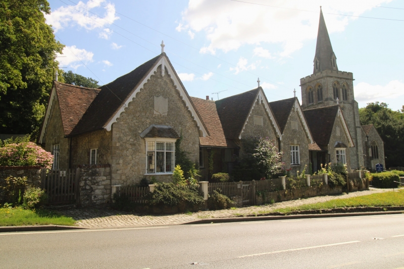
LINTON HILL TQ 75 SE LINTON (East Side) Nos. 1-5 3/137 (Inclusive) The Almshouses GV II Almshouses. Mid C19. Uncoursed ragstone with ashlar dressings. Plain tile roof. E-plan with only slightly projecting wings. Broader central wing comprises 2 gables. Single storey. Cusped bargeboards with moulded finials and pendants to 4 front gables and to slight projection to centre of right return elevation. Roof of main range carried down to rustic posts, forming shelters between wings. Regular 6-window front of one canted bay window to each outer wing, one 3-light leaded casement with top lights to each central gable and 2 similar 2-light casements between wings. 4 ribbed 4-centred arched doors, one to side of each wing, beneath the shelters. Half-glazed door to right return elevation. Raised blank stone shield to each outer gable and recessed rectangular panel to each central gable. Rear return wing to right. Interior not inspected. Almshouses founded on this site by Sir Anthony Mayne, 1611.
Listing NGR: TQ7541850184
External links are from the relevant listing authority and, where applicable, Wikidata. Wikidata IDs may be related buildings as well as this specific building. If you want to add or update a link, you will need to do so by editing the Wikidata entry.


Other nearby listed buildings