Latitude: 54.702 / 54°42'7"N
Longitude: -1.1959 / 1°11'45"W
OS Eastings: 451914
OS Northings: 534399
OS Grid: NZ519343
Mapcode National: GBR NG22.W8
Mapcode Global: WHD6F.L2QR
Plus Code: 9C6WPR23+QJ
Entry Name: Throston Engine House and Wall Adjoining
Listing Date: 21 April 1983
Grade: II
Source: Historic England
Source ID: 1250389
English Heritage Legacy ID: 432706
ID on this website: 101250389
Location: Throston, Hartlepool, County Durham, TS24
County: Hartlepool
Electoral Ward/Division: Headland and Harbour
Parish: Non Civil Parish
Built-Up Area: Hartlepool
Traditional County: Durham
Lieutenancy Area (Ceremonial County): County Durham
Church of England Parish: Hartlepool St Hilda
Church of England Diocese: Durham
Tagged with: Chimney
NZ 53 SW
4/84
21.4.83
HARTLEPOOL
OLD CEMETERY ROAD,
Headland
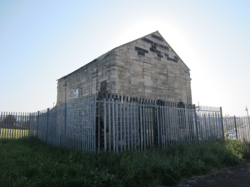
Throston Engine House and wall adjoining.
II
Wrongly shown on O.S. map as Clifton Street. Housing for hauling engine,
1830's, limestone ashlar; gabled Welsh slate roof added later after
removal of header tank. Single storey, with basement fully exposed on
south-east and north-east sides, other two sides concealed by railway
embankment. Each face has Tuscan pilasters and clasping pilasters, rising
from floor string, and with entablature. Rebuilt gables to north-east and
south-west sides, which together with south-east side are each of 3 bays. 2
windows and central doorway to south-west side; 3 windows to south-east
side, all round-headed, with moulded architraves continued to floor string,
and lacking doors and glazing. 4 blocked round-headed openings, that to
left being later, on south-east face of basement. Lower part of north-west
side obscured by remains of contemporary adjoining building, above which,
pilasters define single-bay returns on this side, at each end. Extending
from north angle: a low wall, with string course below parapet, of 2 bays
defined by single pilaster strip on north-east face, and having 2
round-headed openings without glazing. Contains remains of bed of hauling
engine used to draw coal wagons up railway incline to top of former coal
staithes. Dispute between railway companies over use of these coal-shipping
facilities was major factor leading to founding of new town of West
Hartlepool in 1840's.
Listing NGR: NZ5191434399
External links are from the relevant listing authority and, where applicable, Wikidata. Wikidata IDs may be related buildings as well as this specific building. If you want to add or update a link, you will need to do so by editing the Wikidata entry.


Other nearby listed buildings