Latitude: 51.2394 / 51°14'21"N
Longitude: 0.5169 / 0°31'0"E
OS Eastings: 575787
OS Northings: 151925
OS Grid: TQ757519
Mapcode National: GBR PRL.CGG
Mapcode Global: VHJML.X33P
Plus Code: 9F326GQ8+QQ
Entry Name: Olde Hill House
Listing Date: 26 February 1987
Grade: II
Source: Historic England
Source ID: 1250549
English Heritage Legacy ID: 432960
ID on this website: 101250549
Location: Loose, Maidstone, Kent, ME15
County: Kent
District: Maidstone
Civil Parish: Loose
Built-Up Area: Maidstone
Traditional County: Kent
Lieutenancy Area (Ceremonial County): Kent
Tagged with: House
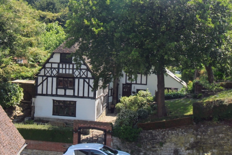
OLD LOOSE HILL TQ 75 SE LOOSE (East Side) 3/191 Olde Hill House GV II House. C17 with later additions and alterations. Rear left section stone, with red and grey brick dressings. Right section rendered. Front wing painted brick on ground floor, rendered above, with applied framing. Plain tile roof. Rear range in 2 short sections, that to right slightly set back. C17 wing of about 2½ timber-framed bays running forwards from, and concealing front of, later left section. 2 storeys and garret. Eaves of wing lower than eaves of rear left section. Applied close-studding and decorative framing to front gable end of wing. Half-hipped roof to left end of rear section and to front of wing. Cusped bargeboards to gable of wing. Rear stack towards centre of left section and gable-end stack to right. Ridge stack in narrow bay at rear end of cross-wing. Truncated projecting brick stack towards front of long left side of wing. Small gabled dormer to rear left section. Irregular fenestration of one 3-light leaded casement to first floor gable end of wing and one 4-light casement to right section. Ribbed door to right section.Norwich Union Fire Insurance plaque to right side of wing. Interior: exposed framing to wing. Gunstock jowls to principal posts. Two brick-vaulted stone-walled cellars at right-angles to left side of wing on ground floor, running into hill.
Listing NGR: TQ7578751925
External links are from the relevant listing authority and, where applicable, Wikidata. Wikidata IDs may be related buildings as well as this specific building. If you want to add or update a link, you will need to do so by editing the Wikidata entry.


Other nearby listed buildings