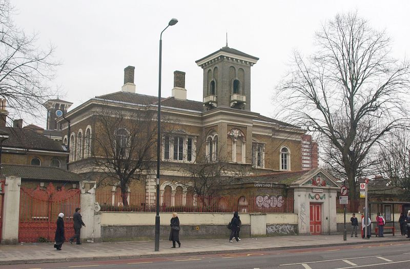
Latitude: 51.5255 / 51°31'31"N
Longitude: -0.0291 / 0°1'44"W
OS Eastings: 536825
OS Northings: 182574
OS Grid: TQ368825
Mapcode National: GBR K3.P9W
Mapcode Global: VHGQV.FXZF
Plus Code: 9C3XGXGC+69
Entry Name: St Clements Hospital
Listing Date: 27 September 1973
Grade: II
Source: Historic England
Source ID: 1251493
English Heritage Legacy ID: 205784
Also known as: City of London Infirmary
ID on this website: 101251493
Location: Festubert Place, Tower Hamlets, London, E3
County: London
District: Tower Hamlets
Electoral Ward/Division: Bromley North
Parish: Non Civil Parish
Built-Up Area: Tower Hamlets
Traditional County: Middlesex
Lieutenancy Area (Ceremonial County): Greater London
Church of England Parish: St Mary Bow and Holy Trinity
Church of England Diocese: London
Tagged with: Hospital building
BOW ROAD E3 1. 4431 (South Side) St Clements Hospital TQ 3682 11/218 II 2. 1849. Formerly City of London Infirmary. Italinate style. Stock brick with stuccoed dressings. Pantiled roofs of shallow pitch. Arched openings, central tower. Formal plan with internal courtyard. Partly damaged by fire. Focus at the end of Coburn Road.
Listing NGR: TQ3682582574
External links are from the relevant listing authority and, where applicable, Wikidata. Wikidata IDs may be related buildings as well as this specific building. If you want to add or update a link, you will need to do so by editing the Wikidata entry.


Other nearby listed buildings