Approximate Location Map
Large Map »
Latitude: 51.3538 / 51°21'13"N
Longitude: -1.9935 / 1°59'36"W
OS Eastings: 400547
OS Northings: 161639
OS Grid: SU005616
Mapcode National: GBR 2V1.0TK
Mapcode Global: VHB4G.D7GH
Plus Code: 9C3W9234+GH
Entry Name: Wall to New Park Road of Brownstone House
Listing Date: 19 September 1972
Grade: II
Source: Historic England
Source ID: 1251614
English Heritage Legacy ID: 434338
ID on this website: 101251614
Location: Devizes, Wiltshire, SN10
County: Wiltshire
Civil Parish: Devizes
Built-Up Area: Devizes
Traditional County: Wiltshire
Lieutenancy Area (Ceremonial County): Wiltshire
Church of England Parish: Devizes St John
Church of England Diocese: Salisbury
Tagged with: Wall
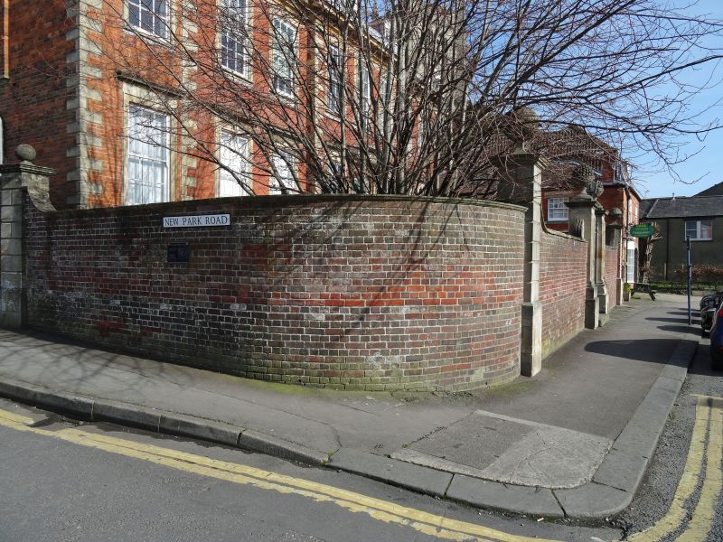
1.
1042 NEW PARK STREET
(North East Side)
Wall to New Park Road
of Brownstone House
SU 0061 3a/159C
II GV
2.
Boundary wall of red brick with stone coping runs from rear of house along
New Park Road to St Mary's Cottages qv.
Brownstone House, No 48 and the Castle Hotel form an important group at the
South end of New Park Street.
Listing NGR: SU0055561654
External links are from the relevant listing authority and, where applicable, Wikidata. Wikidata IDs may be related buildings as well as this specific building. If you want to add or update a link, you will need to do so by editing the Wikidata entry.


Other nearby listed buildings
