Latitude: 50.9529 / 50°57'10"N
Longitude: 0.7354 / 0°44'7"E
OS Eastings: 592220
OS Northings: 120617
OS Grid: TQ922206
Mapcode National: GBR RZ1.0S1
Mapcode Global: FRA D6FL.G9Y
Plus Code: 9F22XP3P+54
Entry Name: 25, Landgate
Listing Date: 11 September 1975
Grade: II
Source: Historic England
Source ID: 1251846
English Heritage Legacy ID: 434577
ID on this website: 101251846
Location: Rye, Rother, East Sussex, TN31
County: East Sussex
District: Rother
Civil Parish: Rye
Built-Up Area: Rye
Traditional County: Sussex
Lieutenancy Area (Ceremonial County): East Sussex
Church of England Parish: Rye
Church of England Diocese: Chichester
Tagged with: Building
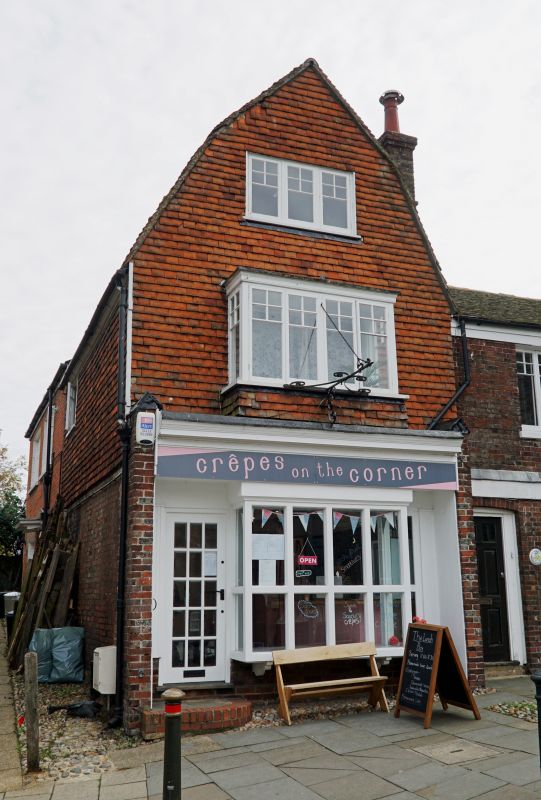
1.
1578 LANDGATE
(East Side)
No 25
TQ 9220 1/275
II GV
2.
C19 house with the gable end of mansard roof facing the street. 3
storeys, 1 window. Upper 2 storeys, tile hung, tiled roof. Modern shop
front on ground floor. Included for group value in this important focal
position by The Landgate.
Nos 25 & 26 form a group together with the North Side of the Landgate.
Listing NGR: TQ9222020625
External links are from the relevant listing authority and, where applicable, Wikidata. Wikidata IDs may be related buildings as well as this specific building. If you want to add or update a link, you will need to do so by editing the Wikidata entry.


Other nearby listed buildings