Latitude: 51.5175 / 51°31'2"N
Longitude: -0.0823 / 0°4'56"W
OS Eastings: 533158
OS Northings: 181582
OS Grid: TQ331815
Mapcode National: GBR TB.N6
Mapcode Global: VHGR0.J4C1
Plus Code: 9C3XGW89+X3
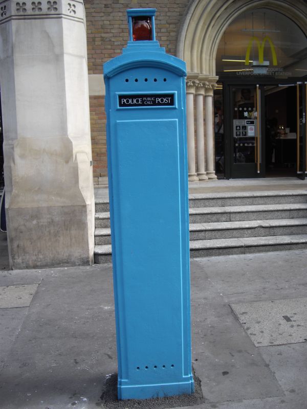
Entry Name: Police Call Box Outside Liverpool Street Station
Listing Date: 26 February 1992
Grade: II
Source: Historic England
Source ID: 1252268
English Heritage Legacy ID: 435247
ID on this website: 101252268
Location: Spitalfields, City of London, London, EC2M
County: London
District: City and County of the City of London
Electoral Ward/Division: Bishopsgate
Parish: Non Civil Parish
Built-Up Area: City of London
Traditional County: Middlesex
Lieutenancy Area (Ceremonial County): City of London
Church of England Parish: St Botolph without Bishopsgate
Church of England Diocese: London
Tagged with: Police box
LIVERPOOL STREET TQ 3381 NW 627-0/5/10000 Police Call Box outside Liverpool Street BR Station.
GV II
Police public call post about 1935 or earlier. Cast iron. Tall, narrow rectangular box having segmental-arched head and narrow projecting hood surmounted by a globular light within a small flat topped cupola with corner bars on a stepped base. Front with door having instructions for use behind a framed glass plate. Above, an opening for name plate surmounted by embossed coat of arms. Below, 2 further flush doors with recessed hand grips. Panelled returns and rear with framed plates inscribed "Police". A rare survival.
Listing NGR: TQ3315881582
External links are from the relevant listing authority and, where applicable, Wikidata. Wikidata IDs may be related buildings as well as this specific building. If you want to add or update a link, you will need to do so by editing the Wikidata entry.


Other nearby listed buildings