Latitude: 51.1529 / 51°9'10"N
Longitude: 1.1108 / 1°6'38"E
OS Eastings: 617642
OS Northings: 143895
OS Grid: TR176438
Mapcode National: GBR TZN.RM1
Mapcode Global: VHLH7.69K0
Plus Code: 9F335436+58
Entry Name: 1 and 2, Cullings Hill
Listing Date: 17 October 1988
Grade: II
Source: Historic England
Source ID: 1252280
English Heritage Legacy ID: 435257
ID on this website: 101252280
Location: Elham, Folkestone and Hythe, Kent, CT4
County: Kent
District: Folkestone and Hythe
Civil Parish: Elham
Built-Up Area: Elham
Traditional County: Kent
Lieutenancy Area (Ceremonial County): Kent
Tagged with: Building
This list entry was subject to a Minor Amendment on 21 November 2025 to amend the name and address and reformat the text to current standards
TR 1643-1743
9/24
ELHAM
CULLINGS HILL (south west side)
Nos 1 and 2
(Formerly listed as Hubbles, CULLINGS HILL)
GV
II
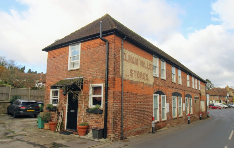
Shop. C19. Painted brick in Flemish bond. Plain tile roof. Two storeys. Roof hipped to left, returning to rear with higher ridge. Regular three-window front of four-pane sashes in open boxes. Ground floor shop front with three lights each side of central half-glazed double doors. Leaded moulded cornice on consoles across whole shop front.
Warehouse forming rear return wing to left; red brick in Flemish bond, plain tile roof hipped to rear, first floor fenestration of eight two-pane sashes, and four broad ground-floor openings with segmental heads.
Interior not inspected. Included for group value.
Listing NGR: TR1764343890
External links are from the relevant listing authority and, where applicable, Wikidata. Wikidata IDs may be related buildings as well as this specific building. If you want to add or update a link, you will need to do so by editing the Wikidata entry.


Other nearby listed buildings