Latitude: 51.5208 / 51°31'14"N
Longitude: -0.0922 / 0°5'32"W
OS Eastings: 532457
OS Northings: 181936
OS Grid: TQ324819
Mapcode National: GBR R9.F0
Mapcode Global: VHGR0.C13G
Plus Code: 9C3XGWC5+84
Entry Name: Whitbread's Brewery Building, Next to the King's Head Public House
Listing Date: 10 October 1990
Last Amended: 7 June 1995
Grade: II
Source: Historic England
Source ID: 1252353
English Heritage Legacy ID: 435351
ID on this website: 101252353
Location: St Luke's, City of London, London, EC1Y
County: London
District: City and County of the City of London
Electoral Ward/Division: Bunhill
Parish: Non Civil Parish
Built-Up Area: Islington
Traditional County: Middlesex
Lieutenancy Area (Ceremonial County): Greater London
Church of England Parish: St Giles Cripplegate
Church of England Diocese: London
Tagged with: Brewery Listed building in the United Kingdom
WHITECROSS STREET TQ3281NW 635-1/78/902 (East side) 10/10/90 Whitbread's Brewery building, next to The King's Head public house
GV II
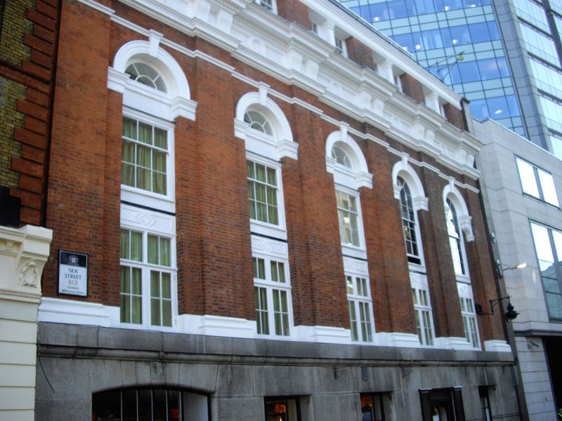
Brewery building. Dated 1904 over left-hand ground-floor opening. Red brick and granite, dressings of stone, roof of lead. Five storeys, five-window range. Granite base to ground floor with segmental-arched opening to left and four flat-arched windows; cornice. First and second floors framed by six giant Doric pilasters supporting bracketed dentil cornice with panelled frieze; the windows themselves originally flat-arched to first floor and round-arched to second under round arches with moulded stucco impost blocks and archivolts; except in the right-hand bay which has a scrolled bracket additionally below the impost block; three second-floor windows to left now flat-arched. Attic storey with flat-arched windows deeply recesed under cornice with engaged Doric antae between; late C20 lead-covered dormer runs the length of the roof between end gables; brewery chimney to south with stone band, panelled frieze and bracketed cornice.
Listing NGR: TQ3245781936
External links are from the relevant listing authority and, where applicable, Wikidata. Wikidata IDs may be related buildings as well as this specific building. If you want to add or update a link, you will need to do so by editing the Wikidata entry.


Other nearby listed buildings