Latitude: 53.8782 / 53°52'41"N
Longitude: -1.6251 / 1°37'30"W
OS Eastings: 424742
OS Northings: 442512
OS Grid: SE247425
Mapcode National: GBR KR2L.YH
Mapcode Global: WHC8Z.0SD8
Plus Code: 9C5WV9HF+7X
Entry Name: Sighting Tower
Listing Date: 7 April 1988
Grade: II
Source: Historic England
Source ID: 1253379
English Heritage Legacy ID: 436559
ID on this website: 101253379
Location: Bramhope, Leeds, West Yorkshire, LS16
County: Leeds
Civil Parish: Bramhope
Traditional County: Yorkshire
Lieutenancy Area (Ceremonial County): West Yorkshire
Church of England Parish: Bramhope St Giles
Church of England Diocese: Leeds
Tagged with: Tower
BRAMHOPE MOORLAND ROAD
SE 24 SW
LS 16 (south side, off)
5/105 Sighting Tower
-
- II
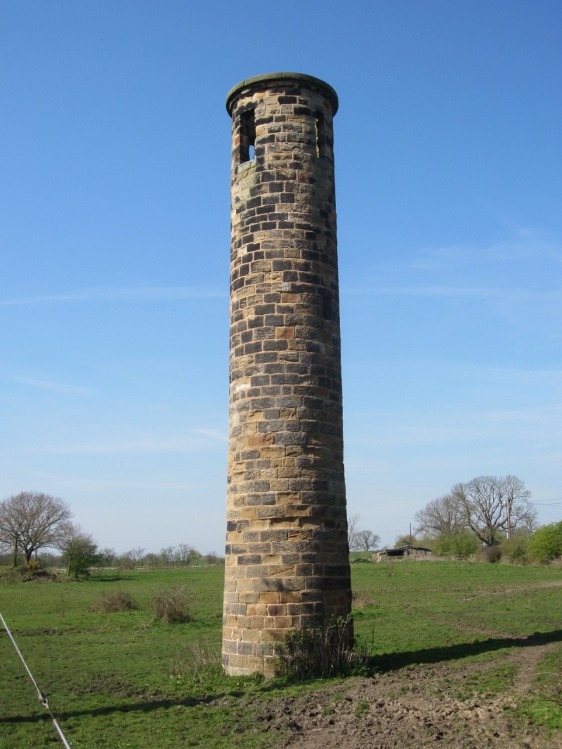
Sighting tower built for construction of Bramhope railway tunnel. Probably
1845, for Leeds-Thirsk Railway. Coursed squared sandstone. Tall cylindrical
structure, approx. 2 metres in diameter, with 4 narrow vertical-rectangular
openings near the top; and a flat coping.
Listing NGR: SE2474242512
External links are from the relevant listing authority and, where applicable, Wikidata. Wikidata IDs may be related buildings as well as this specific building. If you want to add or update a link, you will need to do so by editing the Wikidata entry.


Other nearby listed buildings