Latitude: 53.885 / 53°53'6"N
Longitude: -1.6166 / 1°36'59"W
OS Eastings: 425301
OS Northings: 443273
OS Grid: SE253432
Mapcode National: GBR KR4J.T2
Mapcode Global: WHC8Z.4MG0
Plus Code: 9C5WV9PM+29
Entry Name: Milepost at Se 253 432
Listing Date: 7 April 1988
Grade: II
Source: Historic England
Source ID: 1253384
English Heritage Legacy ID: 436566
ID on this website: 101253384
Location: Bramhope, Leeds, West Yorkshire, LS16
County: Leeds
Civil Parish: Bramhope
Built-Up Area: Bramhope
Traditional County: Yorkshire
Lieutenancy Area (Ceremonial County): West Yorkshire
Church of England Parish: Bramhope St Giles
Church of England Diocese: Leeds
Tagged with: Milestone
BRAMHOPE OTLEY ROAD
SE24SE
LS16 (north side)
6/169 Milepost at SE 253 432
-
- II
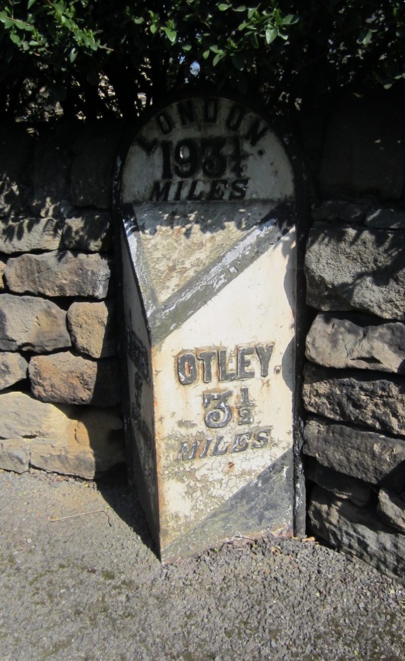
Milepost. Later C19. Sandstone with cast-iron facing plates. Triangular in
section and approx. 1 metre high; flat-faced, semi-circular head and
chamfered sides, with raised lettering:-
LONDON
193½
MILES
LEEDS OTLEY
7 3½
MILES MILES
Listing NGR: SE2530143272
External links are from the relevant listing authority and, where applicable, Wikidata. Wikidata IDs may be related buildings as well as this specific building. If you want to add or update a link, you will need to do so by editing the Wikidata entry.


Other nearby listed buildings