Latitude: 53.8831 / 53°52'59"N
Longitude: -1.6123 / 1°36'44"W
OS Eastings: 425583
OS Northings: 443061
OS Grid: SE255430
Mapcode National: GBR KR5J.RR
Mapcode Global: WHC8Z.6NHH
Plus Code: 9C5WV9MQ+63
Entry Name: Milepost on east corner of junction with Breary Lane, at SE 255 430
Listing Date: 7 April 1988
Grade: II
Source: Historic England
Source ID: 1253385
English Heritage Legacy ID: 436568
ID on this website: 101253385
Location: Bramhope, Leeds, West Yorkshire, LS16
County: Leeds
Civil Parish: Bramhope
Built-Up Area: Bramhope
Traditional County: Yorkshire
Lieutenancy Area (Ceremonial County): West Yorkshire
Church of England Parish: Bramhope St Giles
Church of England Diocese: Leeds
Tagged with: Milestone
This list entry was subject to a Minor Amendment on 20 May 2024 to amend details in the description and to reformat the text to current standards
SE 24 SE
6/112
BRAMHOPE
OTLEY ROAD LS 16 (south side)
Milepost on east corner of junction with Breary Lane, at SE 255 430
II
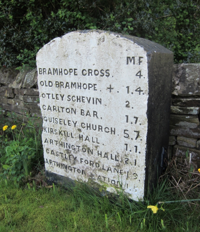
Milepost. Mid C19. Sandstone. Rectangular in section and approx. ½ metre high, with segmentally-rounded top; inscription on the face:-
M.F.
BRAMHOPE CROSS 4
OLD BRAMHOPE + 1.4
OTLEY SCHEVIN 2.
CARLTON BAR 1.7
GUISELEY CHURCH 5.7
KIRSKILL HALL 1.1
ARTHINGTON HALL 2.1
CASTLEY FORD LANE 1.8
ARTHINGTON STATION 1.5
Listing NGR: SE2558343060
External links are from the relevant listing authority and, where applicable, Wikidata. Wikidata IDs may be related buildings as well as this specific building. If you want to add or update a link, you will need to do so by editing the Wikidata entry.


Other nearby listed buildings