Latitude: 53.541 / 53°32'27"N
Longitude: -2.0103 / 2°0'37"W
OS Eastings: 399411
OS Northings: 404931
OS Grid: SD994049
Mapcode National: GBR GWDH.KC
Mapcode Global: WHB9D.28Z6
Plus Code: 9C5VGXRQ+CV
Entry Name: Huddersfield Narrow Canal Halls Bridge and Lock 20W at SD 994 049
Listing Date: 13 June 1995
Grade: II
Source: Historic England
Source ID: 1253531
English Heritage Legacy ID: 436761
ID on this website: 101253531
Location: Lower Arthurs, Oldham, Greater Manchester, OL3
County: Oldham
Civil Parish: Saddleworth
Built-Up Area: Uppermill
Traditional County: Yorkshire
Lieutenancy Area (Ceremonial County): Greater Manchester
Church of England Parish: Friezeland Christ Church
Church of England Diocese: Manchester
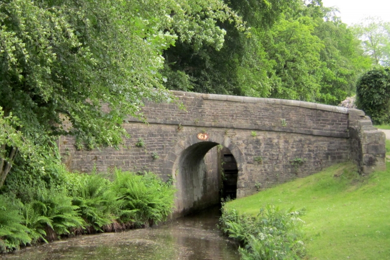
SADDLEWORTH SD 90 SE 1673-0/05/10007 HUDDERSFIELDNARROW CANAL Greenfield Halls Bridge and Lock 20W at SD 994 049 - II Accommodation bridge and lock combination. EC19 with later alterations. Probably designed by Benjamin Outram. Bridge is of coursed, dressed stone. Single. semicircular arch with voussoirs. Stone band and half-round copings to parapet, some showing tow-rope incisions. West side terminates with stone pilasters with stone capstones. East side continuous with tail walls of lock. Lock has stone chamber with stone copings. Tail has pair of double wooden gates, each with manual gate paddle gearing. Head has single wooden gate with two sets of manual ground paddle gearings.
Listing NGR: SD9940004900
External links are from the relevant listing authority and, where applicable, Wikidata. Wikidata IDs may be related buildings as well as this specific building. If you want to add or update a link, you will need to do so by editing the Wikidata entry.


Other nearby listed buildings