Latitude: 53.3791 / 53°22'44"N
Longitude: -1.486 / 1°29'9"W
OS Eastings: 434290
OS Northings: 387043
OS Grid: SK342870
Mapcode National: GBR 9CL.XG
Mapcode Global: WHDDP.4BNB
Plus Code: 9C5W9GH7+MJ
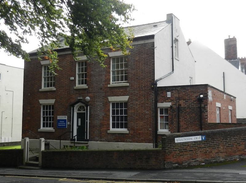
Entry Name: 47, Wilkinson Street
Listing Date: 28 June 1973
Grade: II
Source: Historic England
Source ID: 1254573
English Heritage Legacy ID: 457504
ID on this website: 101254573
Location: Broomfield, Sheffield, South Yorkshire, S10
County: Sheffield
Electoral Ward/Division: Broomhill and Sharrow Vale
Parish: Non Civil Parish
Built-Up Area: Sheffield
Traditional County: Yorkshire
Lieutenancy Area (Ceremonial County): South Yorkshire
Church of England Parish: Sheffield Broomhill St Mark
Church of England Diocese: Sheffield
Tagged with: Building
SHEFFIELD
SK3487SW WILKINSON STREET 784-1/22/784 (South side) 28/06/73 No.47
GV II
House, now offices. c1840, with late C19 additions and C20 alterations. Brick with rendered and colourwashed gables, stone dressings and slate roof with 2 truncated gable stacks. Plinth, moulded wooden eaves. 2 storeys plus garrets; 3 window range of 16 pane sashes, with central 12 pane sash, all with multi-keystone lintels. Central wooden doorcase with pilasters and pediment, with beaded 6-panel door and fanlight. On either side, a 16 pane sash. To right, a single storey flat-roofed addition with a 6 pane sash. Right return has a 9-pane sash to garret. INTERIOR has a plain wooden dogleg stair and several 6-panel doors.
Listing NGR: SK3429087043
External links are from the relevant listing authority and, where applicable, Wikidata. Wikidata IDs may be related buildings as well as this specific building. If you want to add or update a link, you will need to do so by editing the Wikidata entry.


Other nearby listed buildings