Latitude: 52.7063 / 52°42'22"N
Longitude: -2.7587 / 2°45'31"W
OS Eastings: 348832
OS Northings: 312340
OS Grid: SJ488123
Mapcode National: GBR BJ.2FJD
Mapcode Global: WH8BT.L7JM
Plus Code: 9C4VP64R+GG
Entry Name: Coach House and Boundary Wall to Number 6
Listing Date: 19 September 1972
Last Amended: 17 November 1995
Grade: II
Source: Historic England
Source ID: 1254741
English Heritage Legacy ID: 457871
ID on this website: 101254741
Location: Shrewsbury, Shropshire, SY1
County: Shropshire
Civil Parish: Shrewsbury
Built-Up Area: Shrewsbury
Traditional County: Shropshire
Lieutenancy Area (Ceremonial County): Shropshire
Church of England Parish: Shrewsbury St Chad
Church of England Diocese: Lichfield
Tagged with: Carriage house
SHREWSBURY
SJ4812SE QUARRY PLACE 653-1/14/512 (North West side) 19/09/72 Coach House and boundary wall to No.6 (Formerly Listed as: QUARRY PLACE (West side) Stable to Quarry Place House)
GV II
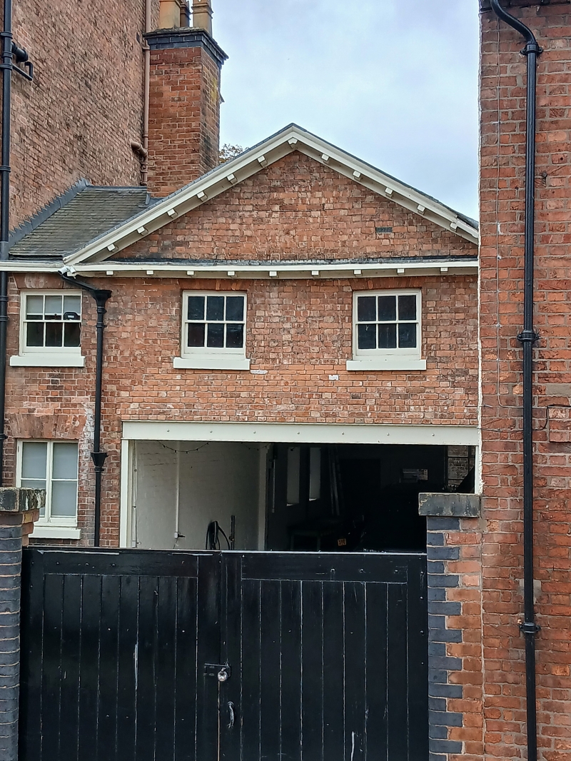
Former coach house. Early C19. Brick with graded Welsh slate roof. 2 storeys, 3-window range. Pedimented gable facing street to right with inserted lower doors, and window in left-hand bay with flat-arched brick head. 6-pane sash windows above. Modillion eaves cornice continues across pediment. SUBSIDIARY FEATURES: curved flanking walls with stone copings screen coach house from street.
Listing NGR: SJ4883212340
External links are from the relevant listing authority and, where applicable, Wikidata. Wikidata IDs may be related buildings as well as this specific building. If you want to add or update a link, you will need to do so by editing the Wikidata entry.


Other nearby listed buildings