Latitude: 52.7048 / 52°42'17"N
Longitude: -2.7496 / 2°44'58"W
OS Eastings: 349448
OS Northings: 312161
OS Grid: SJ494121
Mapcode National: GBR BJ.2PRK
Mapcode Global: WH8BT.Q8WT
Plus Code: 9C4VP732+V5
Entry Name: Memorial Drinking Fountain
Listing Date: 19 September 1972
Last Amended: 17 November 1995
Grade: II
Source: Historic England
Source ID: 1254822
English Heritage Legacy ID: 458055
ID on this website: 101254822
Location: Coleham, Shropshire, SY1
County: Shropshire
Civil Parish: Shrewsbury
Built-Up Area: Shrewsbury
Traditional County: Shropshire
Lieutenancy Area (Ceremonial County): Shropshire
Church of England Parish: Shrewsbury St Chad
Church of England Diocese: Lichfield
Tagged with: Fountain
This list entry was subject to a Minor Amendment on 3 November 2025 to correct a typo in the description and to reformat the text to current standards
SJ4912SW
653-1/15/575
SHREWSBURY
ST JULIAN'S FRIARS
Memorial Drinking Fountain
(Formerly Listed as: Drinking fountain obelisk off St Julian's Friars)
19/09/72
GV
II
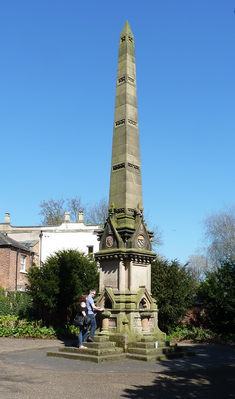
Drinking fountain obelisk. Stone. Dated 1874. Obelisk with stiff-leaf bands raised on high square plinth with gablets over each projecting fountain basin, and stiff-leaf and lotus flower panels. Inscription records that it was erected to the memory of William James Clement, surgeon "by his friends and fellow townsmen in grateful recognition of his enlightened public spirit, consummate professional skill and active private benevolence." Bust of Clement in medallion on opposite face. The obelisk was originally erected outside the station.
Listing NGR: SJ4944812161
External links are from the relevant listing authority and, where applicable, Wikidata. Wikidata IDs may be related buildings as well as this specific building. If you want to add or update a link, you will need to do so by editing the Wikidata entry.


Other nearby listed buildings