Latitude: 52.708 / 52°42'28"N
Longitude: -2.7518 / 2°45'6"W
OS Eastings: 349303
OS Northings: 312523
OS Grid: SJ493125
Mapcode National: GBR BJ.2H71
Mapcode Global: WH8BT.P6TB
Plus Code: 9C4VP65X+57
Entry Name: 17, St Mary's Street
Listing Date: 19 September 1972
Last Amended: 17 November 1995
Grade: II
Source: Historic England
Source ID: 1254842
English Heritage Legacy ID: 458168
ID on this website: 101254842
Location: Shrewsbury, Shropshire, SY1
County: Shropshire
Civil Parish: Shrewsbury
Built-Up Area: Shrewsbury
Traditional County: Shropshire
Lieutenancy Area (Ceremonial County): Shropshire
Church of England Parish: Shrewsbury St Alkmund
Church of England Diocese: Lichfield
Tagged with: Building
SHREWSBURY
SJ4912NW ST MARY'S STREET
653-1/11/593 (West side)
30/05/69 No.17
(Formerly Listed as:
ST MARY'S STREET
(South West side)
No.17
Britland)
GV II
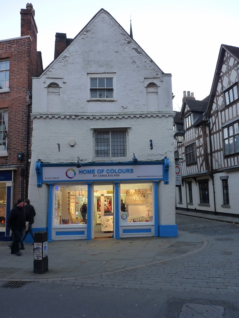
Shop, originally dwelling. Late C17. Painted brick with stone
dressings and plain tiled roof. Gable faces street, 2 storeys
with attic. A single-window range in the gable and also in
return elevation to Church Street. Shop front inserted late
C19.
Central doorway flanked by 2 windows, with continuous fascia
over which is carried on cast-iron columns. Central leaded
2-light casement window above, and 6-pane sash in coped gable,
flanked by segmentally-arched niches with drop-ended
hoodmoulds. Deep dentilled string course above first-floor
window continues across return elevation. Stone angle quoins.
Doorway to right in Church Street elevation, with possible
flying freehold over for the Loggerheads public house (qv),
though the 2 properties were clearly a single build. 3-light
mullioned and transomed window at first floor in this
elevation, and a gabled dormer in the roof.
Listing NGR: SJ4930312521
External links are from the relevant listing authority and, where applicable, Wikidata. Wikidata IDs may be related buildings as well as this specific building. If you want to add or update a link, you will need to do so by editing the Wikidata entry.


Other nearby listed buildings