Latitude: 52.7079 / 52°42'28"N
Longitude: -2.7517 / 2°45'6"W
OS Eastings: 349310
OS Northings: 312512
OS Grid: SJ493125
Mapcode National: GBR BJ.2H85
Mapcode Global: WH8BT.P6WD
Plus Code: 9C4VP65X+58
Entry Name: 15, St Mary's Street
Listing Date: 19 September 1972
Last Amended: 17 November 1995
Grade: II
Source: Historic England
Source ID: 1254841
English Heritage Legacy ID: 458166
ID on this website: 101254841
Location: Shrewsbury, Shropshire, SY1
County: Shropshire
Civil Parish: Shrewsbury
Built-Up Area: Shrewsbury
Traditional County: Shropshire
Lieutenancy Area (Ceremonial County): Shropshire
Church of England Parish: Shrewsbury St Alkmund
Church of England Diocese: Lichfield
Tagged with: Building
SHREWSBURY
SJ4912NW ST MARY'S STREET 653-1/11/591 (West side) 19/09/72 No.15 (Formerly Listed as: ST MARY'S STREET (South West side) Nos.14 AND 15)
GV II
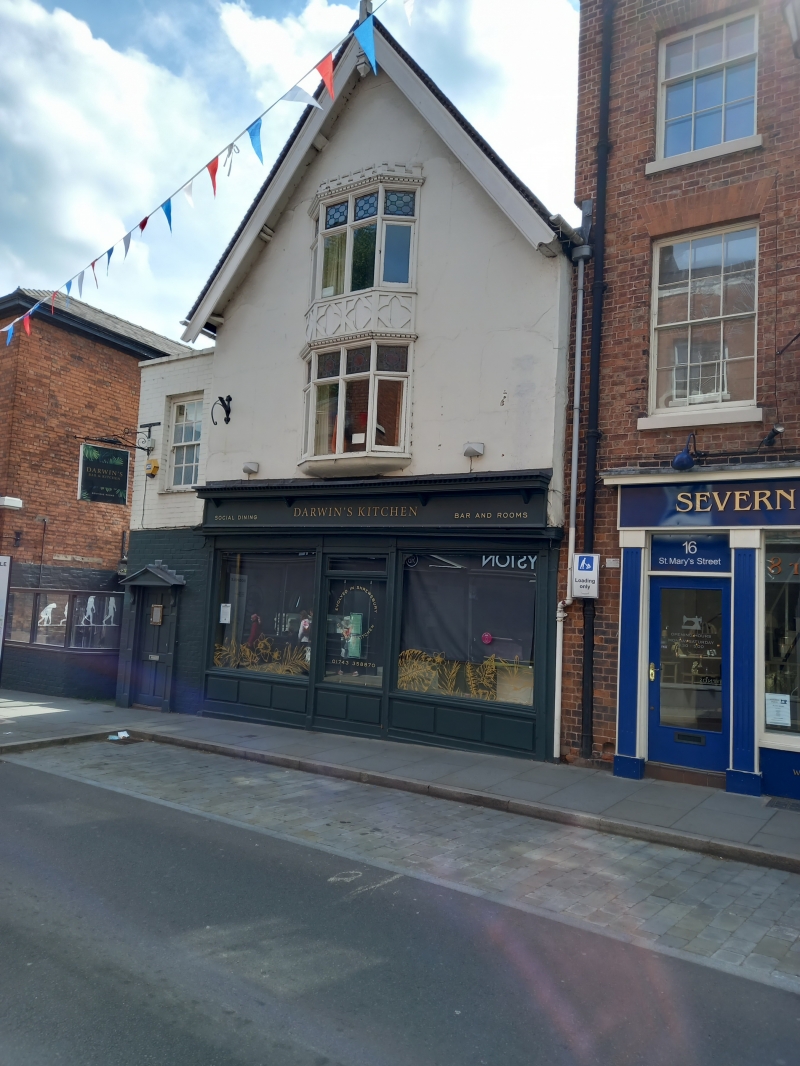
Restaurant, originally dwelling. Early C17 with later alterations including early C20 facade. Brick with mock timber facade and elements of the original timber-framing. Plain tiled roof. Gable faces street, with inserted early C20 shop front, and full-height oriel bay with mullioned and transomed windows above, with quatrefoil panels and castellated parapet. Mock framing in lozenge pattern. Barge-boards with pendant finial. Paired gabled dormers in side wall above flat roofed extension which incorporates remains of earlier brickwork,and contains doorway in vestigial canopy on street elevation, with 12-pane sash window over. INTERIOR: various re-used timbers form ceiling panelling and internal partitions, and there is the partial remains of an early C17 staircase with splat balusters.
Listing NGR: SJ4930412505
External links are from the relevant listing authority and, where applicable, Wikidata. Wikidata IDs may be related buildings as well as this specific building. If you want to add or update a link, you will need to do so by editing the Wikidata entry.


Other nearby listed buildings