Latitude: 52.7077 / 52°42'27"N
Longitude: -2.755 / 2°45'18"W
OS Eastings: 349082
OS Northings: 312498
OS Grid: SJ490124
Mapcode National: GBR BJ.2GDL
Mapcode Global: WH8BT.N68H
Plus Code: 9C4VP65V+3X
Entry Name: 2, Shoplatch
Listing Date: 19 September 1972
Grade: II
Source: Historic England
Source ID: 1254850
English Heritage Legacy ID: 458188
ID on this website: 101254850
Location: Shrewsbury, Shropshire, SY1
County: Shropshire
Civil Parish: Shrewsbury
Built-Up Area: Shrewsbury
Traditional County: Shropshire
Lieutenancy Area (Ceremonial County): Shropshire
Church of England Parish: Shrewsbury St Chad
Church of England Diocese: Lichfield
Tagged with: Building
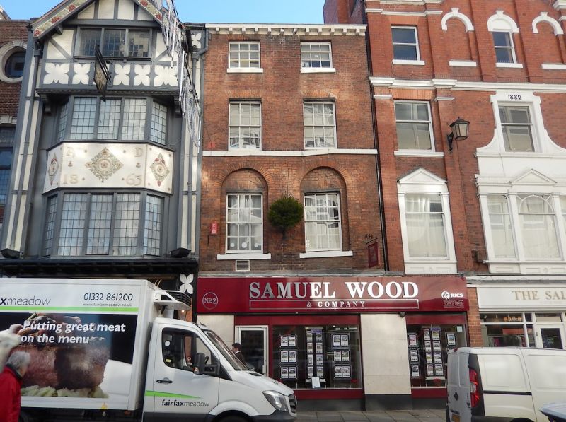
SHREWSBURY
SJ4912SW SHOPLATCH
653-1/15/611 (South East side)
19/09/72 No.2
GV II
Shop, probably built as dwelling. Late C18. Brick with plain
tiled roof. 4 storeys, 2-window range with inserted shop front
to ground floor, and 12-pane sashes with flat-arched gauged
brick heads in round-arched recesses above. Sill band to 2nd
floor windows. Wood modillion eaves cornice, renewed.
Listing NGR: SJ4908212498
External links are from the relevant listing authority and, where applicable, Wikidata. Wikidata IDs may be related buildings as well as this specific building. If you want to add or update a link, you will need to do so by editing the Wikidata entry.


Other nearby listed buildings