Latitude: 52.6945 / 52°41'40"N
Longitude: -2.7743 / 2°46'27"W
OS Eastings: 347766
OS Northings: 311033
OS Grid: SJ477110
Mapcode National: GBR BH.39PK
Mapcode Global: WH8BT.CJ4Q
Plus Code: 9C4VM6VG+Q7
Entry Name: Barn at SJ 477 110 to South of Bank Farm Cottages
Listing Date: 20 May 1982
Last Amended: 17 November 1995
Grade: II
Source: Historic England
Source ID: 1254916
English Heritage Legacy ID: 458340
ID on this website: 101254916
Location: Radbrook, Shropshire, SY3
County: Shropshire
Civil Parish: Shrewsbury
Built-Up Area: Shrewsbury
Traditional County: Shropshire
Lieutenancy Area (Ceremonial County): Shropshire
Church of England Parish: Meole Brace Holy Trinity
Church of England Diocese: Lichfield
Tagged with: Barn
SHREWSBURY
SJ41SE TALCOTT DRIVE, Radbrook 653-1/4/769 Barn at SJ 477 110, to south of Bank 20/05/82 Farm Cottages (Formerly Listed as: BANK FARM ROAD, Radbrook Bank south east of Bank Farmhouse)
II
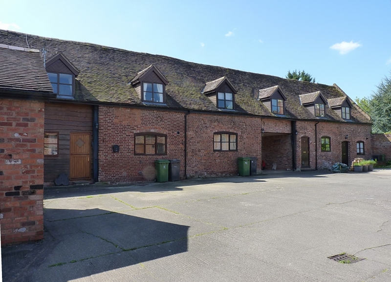
Barn. Later C18. Brick with plain tiled roof. Single-storey with inserted upper floor and dormer windows in the roof. Divided into 3 main sections by full-height entries, that to left possibly a cart entry, the central bay possibly former threshing floor, now partly infilled. Inserted casement windows with single ring cambered heads, and 3 doorways in right-hand section, one possibly original. Series of cruciform vents below eaves in principal sections each side of possible threshing floor. Crow-stepped coped gables with loft loading door and cruciform vents in left gable wall.
Listing NGR: SJ4776611033
External links are from the relevant listing authority and, where applicable, Wikidata. Wikidata IDs may be related buildings as well as this specific building. If you want to add or update a link, you will need to do so by editing the Wikidata entry.


Other nearby listed buildings