Latitude: 52.9512 / 52°57'4"N
Longitude: -1.1543 / 1°9'15"W
OS Eastings: 456914
OS Northings: 339647
OS Grid: SK569396
Mapcode National: GBR LNQ.66
Mapcode Global: WHDGZ.72KW
Plus Code: 9C4WXR2W+F7
Entry Name: 1 and 2, Standard Hill
Listing Date: 12 July 1972
Grade: II
Source: Historic England
Source ID: 1255174
English Heritage Legacy ID: 458866
ID on this website: 101255174
Location: Standard Hill, Nottingham, Nottinghamshire, NG1
County: City of Nottingham
Electoral Ward/Division: Radford and Park
Parish: Non Civil Parish
Built-Up Area: Nottingham
Traditional County: Nottinghamshire
Lieutenancy Area (Ceremonial County): Nottinghamshire
Church of England Parish: Nottingham St Peter with St James
Church of England Diocese: Southwell and Nottingham
Tagged with: Building
NOTTINGHAM
SK5639NE STANDARD HILL 646-1/19/615 (South East side) 12/07/72 Nos.1 & 2
GV II
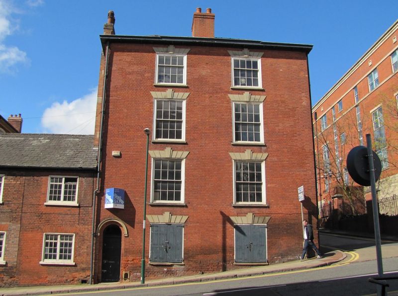
2 houses. c1810-1814. Red brick, with painted ashlar dressings and gabled and hipped slate roof with a coped gable and 2 ridge and single side wall stacks. Rendered plinth, modillion wooden eaves. Corner block, 3 and 4 storeys; 2 x 1 windows. No.1 has a central round-arched doorcase with ashlar head, fielded 6-panel door and fanlight. Above, a single 8-pane sash on each floor, with wedge lintels and double keystones. Left return has to left a moulded round-arched doorcase, and to right two boarded 16-pane sashes, one with a shutter. Above, first and second floors have similar windows, and third floor has 12-pane sashes. All these windows have wedge lintels with double keystones. (Get to know Nottingham: Brand K: The Park estate, Nottingham: Nottingham: 1984-: 9).
Listing NGR: SK5691439646
External links are from the relevant listing authority and, where applicable, Wikidata. Wikidata IDs may be related buildings as well as this specific building. If you want to add or update a link, you will need to do so by editing the Wikidata entry.


Other nearby listed buildings