Latitude: 52.2261 / 52°13'34"N
Longitude: -2.735 / 2°44'5"W
OS Eastings: 349893
OS Northings: 258912
OS Grid: SO498589
Mapcode National: GBR FK.1VLQ
Mapcode Global: VH84W.J9ZS
Plus Code: 9C4V67G8+C2
Entry Name: The Manse and Attached Outbuildings
Listing Date: 24 July 1954
Last Amended: 15 March 1996
Grade: II
Source: Historic England
Source ID: 1255464
English Heritage Legacy ID: 459708
ID on this website: 101255464
Location: Leominster, County of Herefordshire, HR6
County: County of Herefordshire
Civil Parish: Leominster
Built-Up Area: Leominster
Traditional County: Herefordshire
Lieutenancy Area (Ceremonial County): Herefordshire
Church of England Parish: Leominster
Church of England Diocese: Hereford
Tagged with: Architectural structure
LEOMINSTER
SO4958 ETNAM STREET 808-1/2/120 (South side) 24/07/54 The Manse (No.3) and attached outbuildings, Marlow's Court (Formerly Listed as: ETNAM STREET (South side) No.3 (The Manse) Marlows Court)
GV II
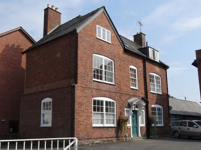
House. c1771. Brick; slate roof with gable to left; brick end stack to rear. 2 storeys and attic; 3-window range: central 6/6 sash and paired 6/6 sashes under segmental arches; metal casement to gable; brick modillion eaves; box-dormer. Central entrance with sidelights: early C20 6-panel door, and fanlight, under moulded and modillioned wood open-pediment hood on scrolled consoles; flanked by paired 6/6 sashes under segmental arches. All fenestration C20. Left returned side: 6/6 sash in C20 brickwork to ground floor. Outbuildings to right. INTERIOR not inspected. Marlow's Court was built in 1771, as a Manse, Chapel and almshouses. (Price, J: An Historical & Topographical Account of Leominster and Vicinity: Ludlow: 1795-: 128-133).
Listing NGR: SO4989358912
External links are from the relevant listing authority and, where applicable, Wikidata. Wikidata IDs may be related buildings as well as this specific building. If you want to add or update a link, you will need to do so by editing the Wikidata entry.


Other nearby listed buildings