Approximate Location Map
Large Map »
Latitude: 52.2257 / 52°13'32"N
Longitude: -2.739 / 2°44'20"W
OS Eastings: 349621
OS Northings: 258868
OS Grid: SO496588
Mapcode National: GBR FK.1TFP
Mapcode Global: VH84W.GBW3
Plus Code: 9C4V67G6+7C
Entry Name: Wall at Dutton House
Listing Date: 9 July 1976
Grade: II
Source: Historic England
Source ID: 1255520
English Heritage Legacy ID: 459832
ID on this website: 101255520
Location: Leominster, County of Herefordshire, HR6
County: County of Herefordshire
Civil Parish: Leominster
Built-Up Area: Leominster
Traditional County: Herefordshire
Lieutenancy Area (Ceremonial County): Herefordshire
Church of England Parish: Leominster
Church of England Diocese: Hereford
Tagged with: Wall
LEOMINSTER
SO4958 SOUTH STREET
808-1/2/212 (East side)
09/07/76 Wall at Dutton House
GV II
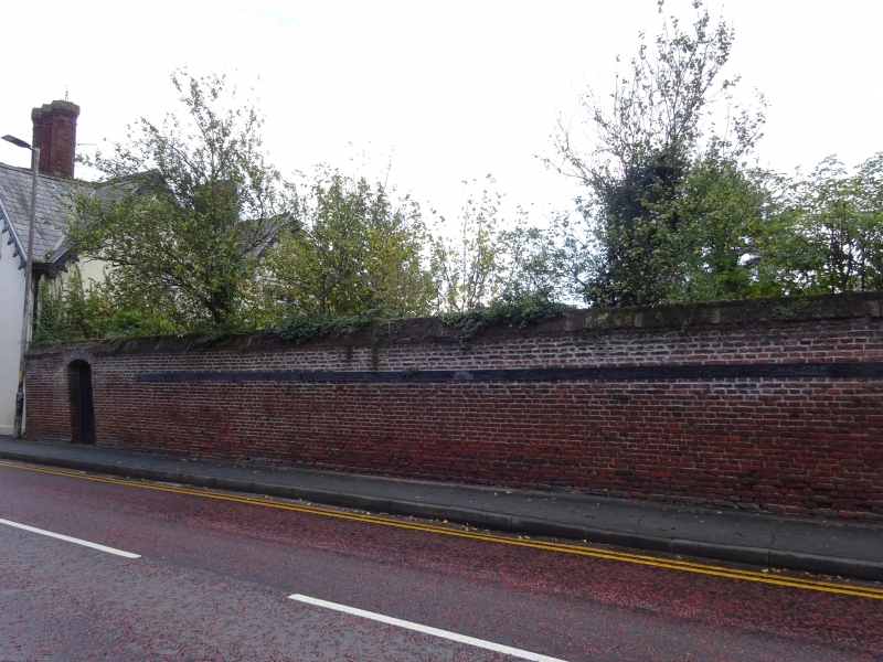
Garden wall. C17 with later additions. Brick. Approx 3m high.
Extends for approx 50m to south, then returned to east.
Contains C20 plank door under segmental arch.
Listing NGR: SO4962158868
External links are from the relevant listing authority and, where applicable, Wikidata. Wikidata IDs may be related buildings as well as this specific building. If you want to add or update a link, you will need to do so by editing the Wikidata entry.


Other nearby listed buildings
