Approximate Location Map
Large Map »
Latitude: 51.4478 / 51°26'52"N
Longitude: -1.0708 / 1°4'14"W
OS Eastings: 464668
OS Northings: 172498
OS Grid: SU646724
Mapcode National: GBR B4D.048
Mapcode Global: VHCZ9.DW80
Plus Code: 9C3WCWXH+4M
Entry Name: Garden Wall Approximately 10 Metres to South of Nunhide Manor
Listing Date: 19 June 1984
Grade: II
Source: Historic England
Source ID: 1255541
English Heritage Legacy ID: 459862
ID on this website: 101255541
Location: West Berkshire, RG8
County: West Berkshire
Civil Parish: Sulham
Traditional County: Berkshire
Lieutenancy Area (Ceremonial County): Berkshire
Church of England Parish: Pangbourne with Tidmarsh and Sulham
Church of England Diocese: Oxford
Tagged with: Wall
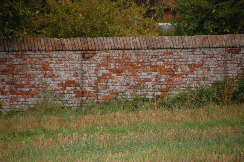
SU 67 SW SULHAM NUNHIDE LANE (east side)
4/26 Garden Wall Approximately
10 Metres To South Of
Nunhide Manor
G.V. II
Garden Wall. Mid C18. Red brick wall in Flemish bond, panelled to north
with angled coping. Approximately 2 metres tall and 50 metres long.
Included for group value.
Listing NGR: SU6466872498
External links are from the relevant listing authority and, where applicable, Wikidata. Wikidata IDs may be related buildings as well as this specific building. If you want to add or update a link, you will need to do so by editing the Wikidata entry.


Other nearby listed buildings
