Approximate Location Map
Large Map »
Latitude: 51.474 / 51°28'26"N
Longitude: -2.7694 / 2°46'9"W
OS Eastings: 346658
OS Northings: 175290
OS Grid: ST466752
Mapcode National: GBR JH.L835
Mapcode Global: VH7C2.Y69T
Plus Code: 9C3VF6FJ+J6
Entry Name: Guidestone at Junction of Clapton Lane and Clevedon Road
Listing Date: 22 April 1994
Grade: II
Source: Historic England
Source ID: 1255544
English Heritage Legacy ID: 459872
ID on this website: 101255544
Location: North Weston, North Somerset, BS20
County: North Somerset
Civil Parish: Portishead
Built-Up Area: Portishead
Traditional County: Somerset
Lieutenancy Area (Ceremonial County): Somerset
Tagged with: Milestone
ST 47 NE PORTISHEAD CLAPTON LANE
(south west side)
2/92
Guidestone atjunction of
Clapton Lane and
Clevedon Road
II
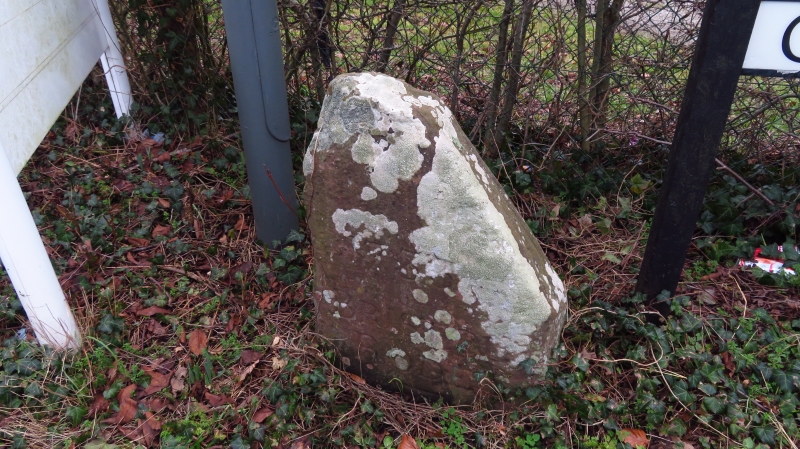
Guidestone. Dated 1733. Large irregular block of sandstone. Fine quality
lettering: BRISTOL RODE and benchmark at base.
Listing NGR: ST4665875290
External links are from the relevant listing authority and, where applicable, Wikidata. Wikidata IDs may be related buildings as well as this specific building. If you want to add or update a link, you will need to do so by editing the Wikidata entry.


Other nearby listed buildings
