Approximate Location Map
Large Map »
Latitude: 51.2804 / 51°16'49"N
Longitude: 1.0808 / 1°4'50"E
OS Eastings: 614952
OS Northings: 157979
OS Grid: TR149579
Mapcode National: GBR TY2.Q2N
Mapcode Global: VHLGM.P27S
Plus Code: 9F3373JJ+58
Entry Name: 6, Palace Street
Listing Date: 7 September 1973
Grade: II
Source: Historic England
Source ID: 1255546
English Heritage Legacy ID: 440494
ID on this website: 101255546
Location: Canterbury, Kent, CT1
County: Kent
District: Canterbury
Electoral Ward/Division: Westgate
Parish: Non Civil Parish
Built-Up Area: Canterbury
Traditional County: Kent
Lieutenancy Area (Ceremonial County): Kent
Tagged with: Building
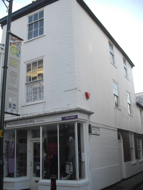
1.
944 PALACE STREET
(West Side)
No 6
TR 1457 NE 4/280
II GV
2.
C18 facade. 3 storeys painted brick. Wooden modillion cornice. 1 sash with
glazing bars intact. Later C19 shop front. The side elevation, which is
stuccoed, has 2 sashes and a round-headed doorcase with fanlight and 6 panelled
door. Extension of 2 storeys with a simple doorcase and double-hung sash.
Nos 1, 2 and Nos 4 to 8 (consec) form a group.
Listing NGR: TR1494657981
External links are from the relevant listing authority and, where applicable, Wikidata. Wikidata IDs may be related buildings as well as this specific building. If you want to add or update a link, you will need to do so by editing the Wikidata entry.


Other nearby listed buildings
