Latitude: 53.793 / 53°47'34"N
Longitude: -1.5514 / 1°33'4"W
OS Eastings: 429650
OS Northings: 433061
OS Grid: SE296330
Mapcode National: GBR BHN.B2
Mapcode Global: WHC9D.4XJK
Plus Code: 9C5WQCVX+6C
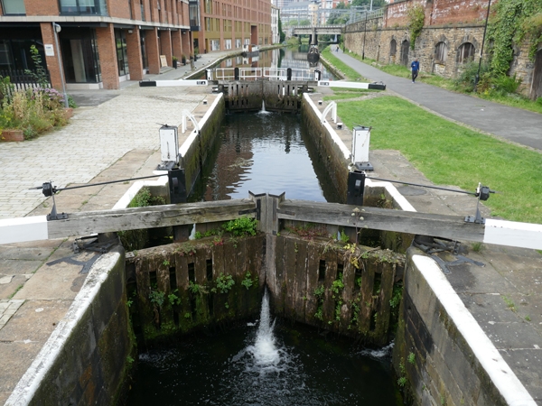
Entry Name: Basin Lock to West of Bridge 226 on Leeds and Liverpool Canal
Listing Date: 5 August 1976
Last Amended: 11 September 1996
Grade: II
Source: Historic England
Source ID: 1255704
English Heritage Legacy ID: 465739
ID on this website: 101255704
Location: Granary Wharf, Leeds, West Yorkshire, LS11
County: Leeds
Electoral Ward/Division: City and Hunslet
Parish: Non Civil Parish
Built-Up Area: Leeds
Traditional County: Yorkshire
Lieutenancy Area (Ceremonial County): West Yorkshire
Church of England Parish: Hunslet St Mary the Virgin
Church of England Diocese: Leeds
Tagged with: Lock
LEEDS
SE2933SE CANAL WHARF 714-1/77/82 Basin Lock to west of Bridge 226 on 05/08/76 Leeds and Liverpool Canal (Formerly Listed as: LEEDS AND LIVERPOOL CANAL Lock at Canal Wharf (LS11))
GV II
Lock on the Leeds and Liverpool Canal. 1770-77, gates restored. Millstone grit retaining walls, wood and iron gates. Double gates, walkway across western pair; boxed paddle mechanism.
Listing NGR: SE2965033061
External links are from the relevant listing authority and, where applicable, Wikidata. Wikidata IDs may be related buildings as well as this specific building. If you want to add or update a link, you will need to do so by editing the Wikidata entry.


Other nearby listed buildings