Approximate Location Map
Large Map »
Latitude: 53.7995 / 53°47'58"N
Longitude: -1.6056 / 1°36'20"W
OS Eastings: 426073
OS Northings: 433765
OS Grid: SE260337
Mapcode National: GBR B3K.RR
Mapcode Global: WHC9C.9RNK
Plus Code: 9C5WQ9XV+RQ
Entry Name: The Towers
Listing Date: 11 September 1996
Grade: II
Source: Historic England
Source ID: 1255928
English Heritage Legacy ID: 465457
ID on this website: 101255928
Location: Upper Armley, Leeds, West Yorkshire, LS12
County: Leeds
Electoral Ward/Division: Armley
Parish: Non Civil Parish
Built-Up Area: Leeds
Traditional County: Yorkshire
Lieutenancy Area (Ceremonial County): West Yorkshire
Church of England Parish: Upper Armley Christ Church
Church of England Diocese: Leeds
Tagged with: Building
LEEDS
SE2633 HILL TOP ROAD, Armley Hill Top
714-1/32/505 (North side (off))
Nos.21, 23 AND 25
The Towers
GV II
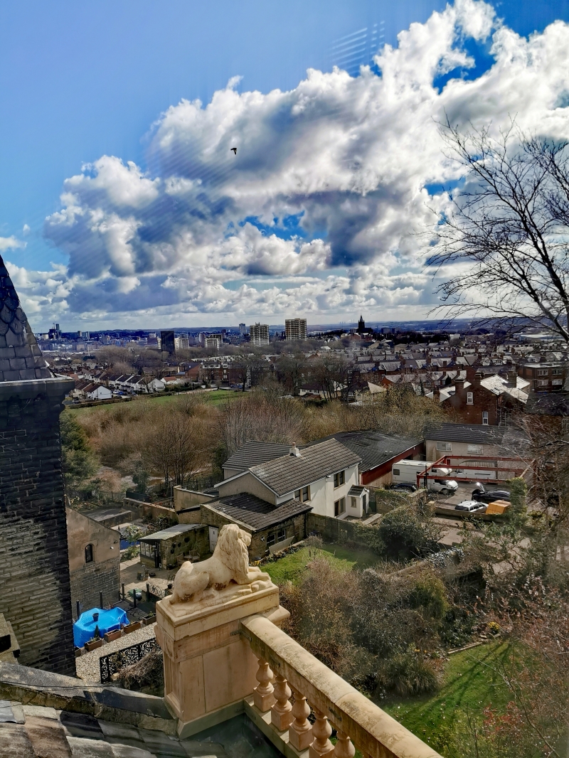
Row of 3 houses with terrace walls. Late C19. Coursed
rock-faced gritstone, slate roofs. 2 storeys with basements
and attics, each house of 3 bays with central entrance in
projecting bay. No.21 (right): panelled door with fine etched
glass, overlight, hood, flanking 3-light bay windows, 2-light
mullioned windows above, sash in architrave above entrance and
round-arched tower window, eaves brackets, panelled blocking
course to flanking bays, tower has steeply pitched fish-scale
slate roof with ornate cast-iron finial; corniced end stacks.
Nos 23 & 25 are similar: panelled door, hood on console
brackets, 3-light bay windows, one a canted bay, oriel window
1st-floor centre, round-arched attic window in ornate ogee
gable with urn finial; large tapering tower with slate-hung
walls and round-arched windows, elaborate cast-iron railings
form cresting. Balustraded eaves parapet and terrace walling
with lions.
INTERIOR: not inspected.
Listing NGR: SE2607333765
External links are from the relevant listing authority and, where applicable, Wikidata. Wikidata IDs may be related buildings as well as this specific building. If you want to add or update a link, you will need to do so by editing the Wikidata entry.


Other nearby listed buildings
