Latitude: 53.8012 / 53°48'4"N
Longitude: -1.5518 / 1°33'6"W
OS Eastings: 429616
OS Northings: 433970
OS Grid: SE296339
Mapcode National: GBR BHK.75
Mapcode Global: WHC9D.4Q99
Plus Code: 9C5WRC2X+F7
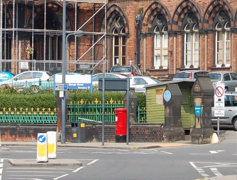
Entry Name: Boundary Wall and Railings to Leeds General Infirmary with Gate Piers and Gates
Listing Date: 8 October 1970
Last Amended: 11 September 1996
Grade: II
Source: Historic England
Source ID: 1256243
English Heritage Legacy ID: 465139
ID on this website: 101256243
Location: Leeds, West Yorkshire, LS1
County: Leeds
Electoral Ward/Division: City and Hunslet
Parish: Non Civil Parish
Built-Up Area: Leeds
Traditional County: Yorkshire
Lieutenancy Area (Ceremonial County): West Yorkshire
Church of England Parish: Leeds St George
Church of England Diocese: Leeds
Tagged with: Wall
LEEDS
SE2933NE GREAT GEORGE STREET 714-1/75/197 (North side) 08/10/70 Boundary wall and railings to Leeds General Infirmary with gate piers and gates (Formerly Listed as: GREAT GEORGE STREET (North side) Boundary wall and Gates to Leeds General Infirmary)
GV II
Boundary wall with railings and gate piers. 1863-8, altered late C19. By Sir George Gilbert Scott. Brick, English bond, ashlar and brick piers, stone copings and details, wrought-iron railings. Overall length approx 100m, height of railings approx 1-1.5m and gate piers 2m. The length fronting the original Infirmary is angled to turn corner into Thoresby Place, left and has inner and outer piers with crocket-style finials with railings fronting left return of Infirmary; at the right (east) end the walling is interrupted by the wide carriage entrance flanked by narrower pedestrian gateways, gates missing. Roll moulding to wall coping, railings with zigzag interlaced iron straps, C-scroll plaques and flower-bud finials; brick piers with corniced capstones and trefoil plaques to finials. Main gate piers are square in section, have attached corner shafts with foliate capitals, gabled capstones, the inner pair elaborated with carved foliage to entablature and plaque on gable front. The 1891 Ordnance Survey map shows the curved carriage drive with angled gateways at each end; the gateway right was probably repositioned when the extension was added to the hospital late C19.
Listing NGR: SE2961633969
External links are from the relevant listing authority and, where applicable, Wikidata. Wikidata IDs may be related buildings as well as this specific building. If you want to add or update a link, you will need to do so by editing the Wikidata entry.


Other nearby listed buildings