Latitude: 53.2602 / 53°15'36"N
Longitude: -1.9135 / 1°54'48"W
OS Eastings: 405868
OS Northings: 373689
OS Grid: SK058736
Mapcode National: GBR HZ2R.J1
Mapcode Global: WHBBS.LB10
Plus Code: 9C5W736P+3J
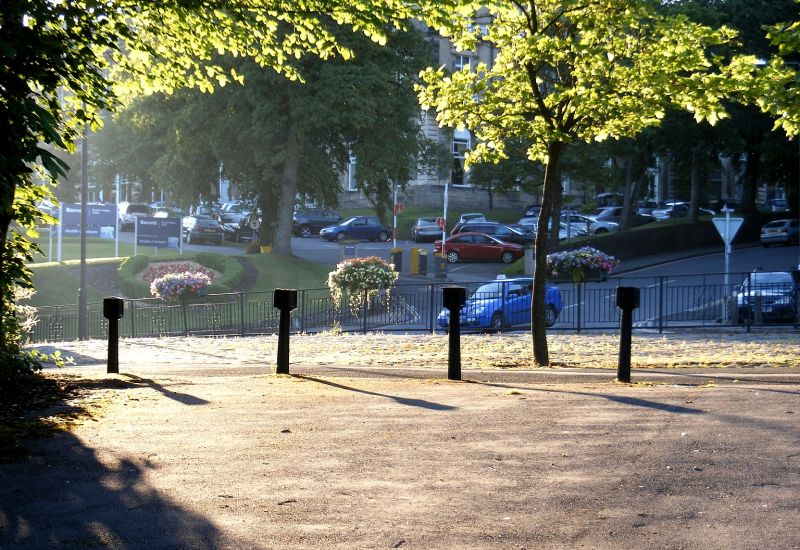
Entry Name: 7 Bollards at Junction with Station Road
Listing Date: 31 January 1997
Grade: II
Source: Historic England
Source ID: 1257932
English Heritage Legacy ID: 463283
ID on this website: 101257932
Location: Buxton, High Peak, Derbyshire, SK17
County: Derbyshire
District: High Peak
Electoral Ward/Division: Buxton Central
Parish: Non Civil Parish
Built-Up Area: Buxton
Traditional County: Derbyshire
Lieutenancy Area (Ceremonial County): Derbyshire
Church of England Parish: Fairfield St Peter
Church of England Diocese: Derby
Tagged with: Bollard
BUXTON
SK0573NE STATION APPROACH 616-1/3/71 7 bollards at junction with Station Road
II
Seven cast-iron bollards. 1864. Cast-iron. Each bollard has a fluted tapering column surmounted by open cube with recessed panel to each face, the first and third bollards have pyramidal top. The date 1864 is visible on all bollards but variously aligned. Each bollard is approximately 85cm in height. Originally there were eight bollards, one has been replaced by a late C20 steel post.
Listing NGR: SK0586873689
External links are from the relevant listing authority and, where applicable, Wikidata. Wikidata IDs may be related buildings as well as this specific building. If you want to add or update a link, you will need to do so by editing the Wikidata entry.


Other nearby listed buildings