Approximate Location Map
Large Map »
Latitude: 52.8428 / 52°50'34"N
Longitude: -2.1753 / 2°10'30"W
OS Eastings: 388292
OS Northings: 327271
OS Grid: SJ882272
Mapcode National: GBR 168.NWC
Mapcode Global: WHBDL.KSCZ
Plus Code: 9C4VRRVF+4V
Entry Name: Bridgeford Hall
Listing Date: 15 January 1968
Grade: II
Source: Historic England
Source ID: 1258051
English Heritage Legacy ID: 444179
ID on this website: 101258051
Location: Great Bridgeford, Stafford, Staffordshire, ST18
County: Staffordshire
District: Stafford
Civil Parish: Seighford
Traditional County: Staffordshire
Lieutenancy Area (Ceremonial County): Staffordshire
Church of England Parish: Seighford St Chad
Church of England Diocese: Lichfield
Tagged with: House
SEIGHFORD
1.
2385
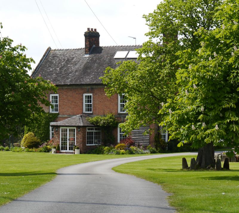
Bridgeford Hall
BY 82 NE 12/16 15.1.68.
II
2.
Probably C17 in origin but much altered in C18. Originally timber framed
but now largely brick faced. Tiled roof and brick stacks; coped gables;
2 storeys and attic; sash and casement windows; 3 window front; 3 dormers.
Door has rectangular fanlight.
Listing NGR: SJ8829227271
External links are from the relevant listing authority and, where applicable, Wikidata. Wikidata IDs may be related buildings as well as this specific building. If you want to add or update a link, you will need to do so by editing the Wikidata entry.


Other nearby listed buildings
