Approximate Location Map
Large Map »
Latitude: 51.2752 / 51°16'30"N
Longitude: 1.0756 / 1°4'32"E
OS Eastings: 614616
OS Northings: 157383
OS Grid: TR146573
Mapcode National: GBR TY2.W7N
Mapcode Global: VHLGM.L6HT
Plus Code: 9F3373GG+37
Entry Name: Don Jon House
Listing Date: 14 September 1976
Grade: II
Source: Historic England
Source ID: 1258230
English Heritage Legacy ID: 444614
ID on this website: 101258230
Location: Canterbury, Kent, CT1
County: Kent
District: Canterbury
Electoral Ward/Division: Westgate
Parish: Non Civil Parish
Built-Up Area: Canterbury
Traditional County: Kent
Lieutenancy Area (Ceremonial County): Kent
Tagged with: House
1.
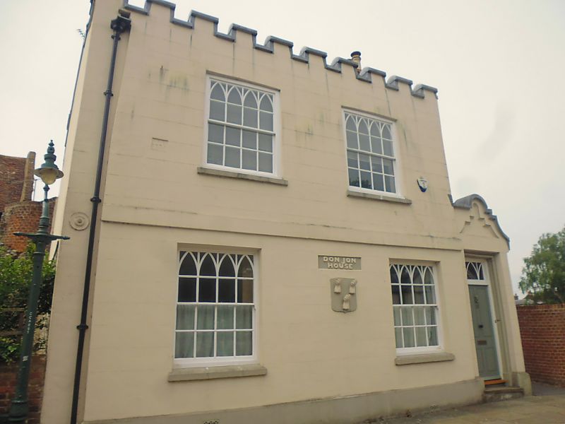
944 WORTHGATE PLACE
No 12
TR 1457 SE 8/737 (Bon Jon House)
II
2.
2 parallel range. Front range dated 1774, rear range of earlier origin. 2 storeys
colourwashed. Slate roof with crenellated Parapet. Stringcourse. 2 sashes with
'Gothick' heads. Doorcase set in right side passage extension with curved gable
over. Rectangular fanlight with 'Gothick' glazing. 4 panelled. door. This
building was a Public House called The Bell in the C18.
Listing NGR: TR1461257384
External links are from the relevant listing authority and, where applicable, Wikidata. Wikidata IDs may be related buildings as well as this specific building. If you want to add or update a link, you will need to do so by editing the Wikidata entry.


Other nearby listed buildings
