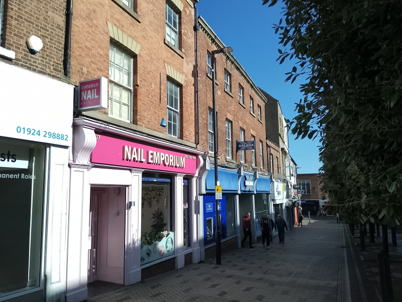
Latitude: 53.6829 / 53°40'58"N
Longitude: -1.4955 / 1°29'43"W
OS Eastings: 433419
OS Northings: 420829
OS Grid: SE334208
Mapcode National: GBR LT0V.0J
Mapcode Global: WHDC4.0P4J
Plus Code: 9C5WMGM3+4R
Entry Name: 17, Kirkgate
Listing Date: 1 February 1979
Grade: II
Source: Historic England
Source ID: 1258240
English Heritage Legacy ID: 444622
ID on this website: 101258240
Location: Wakefield, West Yorkshire, WF1
County: Wakefield
Electoral Ward/Division: Wakefield North
Parish: Non Civil Parish
Built-Up Area: Wakefield
Traditional County: Yorkshire
Lieutenancy Area (Ceremonial County): West Yorkshire
Church of England Parish: Wakefield All Saints
Church of England Diocese: Leeds
Tagged with: Building
1. KIRKGATE 5115 (North Side) No 17 SE 3320 NW 2/171
II GV 2. 2nd quarter of C19. 2-storey. 2 windows. Red brick with stone frieze and moulded eaves cornice to Welsh slate root. Stone voussoirs and cills to sash windows, lost bars ; 2nd floor windows altered. Modern shop front continues over next building (Nos 19 and 21). Included partly for group value.
Listing NGR: SE3341920829
External links are from the relevant listing authority and, where applicable, Wikidata. Wikidata IDs may be related buildings as well as this specific building. If you want to add or update a link, you will need to do so by editing the Wikidata entry.


Other nearby listed buildings