Latitude: 52.7916 / 52°47'29"N
Longitude: -2.0384 / 2°2'18"W
OS Eastings: 397505
OS Northings: 321559
OS Grid: SJ975215
Mapcode National: GBR 28C.TR2
Mapcode Global: WHBF1.N3J7
Plus Code: 9C4VQXR6+JJ
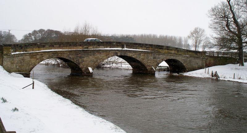
Entry Name: Holdiford Bridge (Over River Sow)
Listing Date: 15 January 1968
Grade: II
Source: Historic England
Source ID: 1258302
English Heritage Legacy ID: 444737
ID on this website: 101258302
Location: Milford, Stafford, Staffordshire, ST18
County: Staffordshire
District: Stafford
Civil Parish: Berkswich
Traditional County: Staffordshire
Lieutenancy Area (Ceremonial County): Staffordshire
Church of England Parish: Tixall St John the Baptist
Church of England Diocese: Lichfield
Tagged with: Bridge
TIXALL 1. 2385 Holdiford Bridge SJ 92 SE 19/9 (over River Sow) 15.1.68. II
2. Probably late C18. Ashlar and of 3 spans with segmental arches, the central higher than others. Moulded stringcourse on both sides.
Listing NGR: SJ9750521559
External links are from the relevant listing authority and, where applicable, Wikidata. Wikidata IDs may be related buildings as well as this specific building. If you want to add or update a link, you will need to do so by editing the Wikidata entry.


Other nearby listed buildings