Latitude: 51.067 / 51°4'1"N
Longitude: -1.7949 / 1°47'41"W
OS Eastings: 414466
OS Northings: 129762
OS Grid: SU144297
Mapcode National: GBR 51F.305
Mapcode Global: FRA 7649.DJS
Plus Code: 9C3W3684+R2
Entry Name: 7, New Street
Listing Date: 28 February 1952
Grade: II
Source: Historic England
Source ID: 1258328
English Heritage Legacy ID: 444799
ID on this website: 101258328
Location: The Friary, Wiltshire, SP1
County: Wiltshire
Civil Parish: Salisbury
Built-Up Area: Salisbury
Traditional County: Wiltshire
Lieutenancy Area (Ceremonial County): Wiltshire
Church of England Parish: Salisbury St Thomas and St Edmund
Church of England Diocese: Salisbury
Tagged with: Building
1.
1594
SU 1428 NW
3/116
28.2.52
NEW STREET
(South Side)
No 7
II
GV
2.
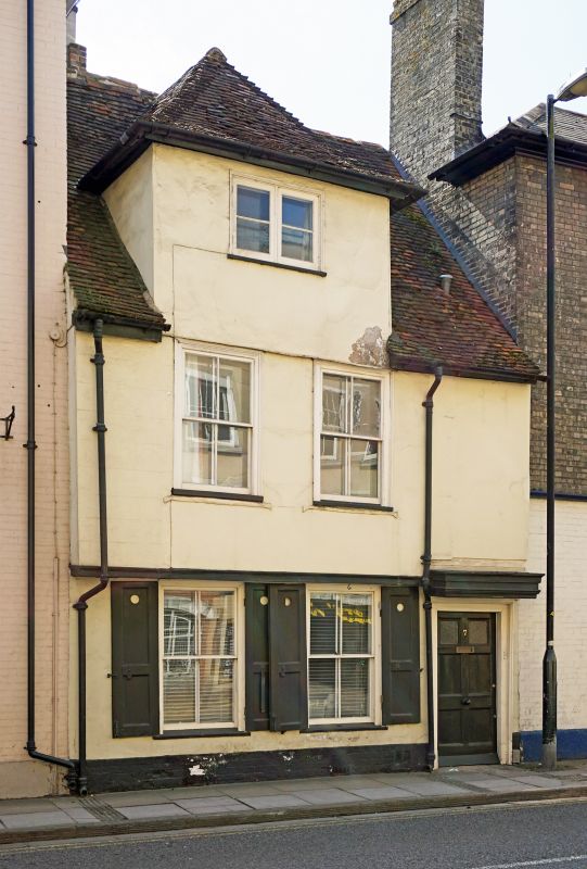
C16/C15 timber frame C18 and C19 alterations. 2 storeys and attic brick plinth.
timber frame stuccoed oversailing lst floor. Steep pitch gable end old tile
roof. 2 light attic casement in wall face carried up over
1st floor forming a large dormer with hipped roof. 2 windows 1st floor C18
moulded flush frames. C19 sashes. A sash window on ground floor with panelled
shutters. To right hand a door of 6 fielded panels in architrave case with
heavy cantilevered hood.
Interior front room to street has C18 fielded panelling.
Nos 1 to 11 (odd) form a group.
Listing NGR: SU1446629762
External links are from the relevant listing authority and, where applicable, Wikidata. Wikidata IDs may be related buildings as well as this specific building. If you want to add or update a link, you will need to do so by editing the Wikidata entry.


Other nearby listed buildings