Approximate Location Map
Large Map »
Latitude: 51.4387 / 51°26'19"N
Longitude: 0.7626 / 0°45'45"E
OS Eastings: 592102
OS Northings: 174702
OS Grid: TQ921747
Mapcode National: GBR RS2.MMK
Mapcode Global: VHKJ7.53JD
Plus Code: 9F32CQQ7+F2
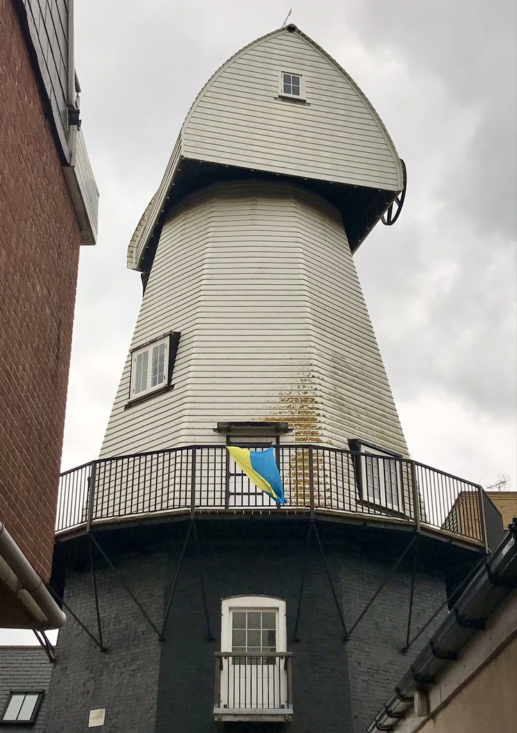
Entry Name: Remains of Cornmill to Rear of Number 111
Listing Date: 30 June 1978
Grade: II
Source: Historic England
Source ID: 1258330
English Heritage Legacy ID: 444800
Also known as: Great Mill, Sheerness
Ride's Mill
ID on this website: 101258330
Location: Sheerness, Swale, Kent, ME12
County: Kent
District: Swale
Town: Swale
Electoral Ward/Division: Sheerness
Parish: Sheerness
Built-Up Area: Sheerness
Traditional County: Kent
Lieutenancy Area (Ceremonial County): Kent
Tagged with: Smock mill
HIGH STREET
1.
5282
(West Side)
Mile Town, Sheerness
Remains of corn mill
to rear of No 111
TQ 9274 NW 9/31
II
2.
Early C19. An octagonal base of 2 storeys stock brick. Glazing now missing
from windows.
Listing NGR: TQ9210274702
External links are from the relevant listing authority and, where applicable, Wikidata. Wikidata IDs may be related buildings as well as this specific building. If you want to add or update a link, you will need to do so by editing the Wikidata entry.


Other nearby listed buildings
