Approximate Location Map
Large Map »
Latitude: 51.4398 / 51°26'23"N
Longitude: 0.7611 / 0°45'40"E
OS Eastings: 591996
OS Northings: 174814
OS Grid: TQ919748
Mapcode National: GBR RS2.M86
Mapcode Global: VHKJ7.42RL
Plus Code: 9F32CQQ6+WF
Entry Name: Bethel Chapel Sunday School
Listing Date: 30 June 1978
Grade: II
Source: Historic England
Source ID: 1273419
English Heritage Legacy ID: 445084
ID on this website: 101273419
Location: Sheerness, Swale, Kent, ME12
County: Kent
District: Swale
Electoral Ward/Division: Sheerness
Parish: Sheerness
Built-Up Area: Sheerness
Traditional County: Kent
Lieutenancy Area (Ceremonial County): Kent
Tagged with: School building
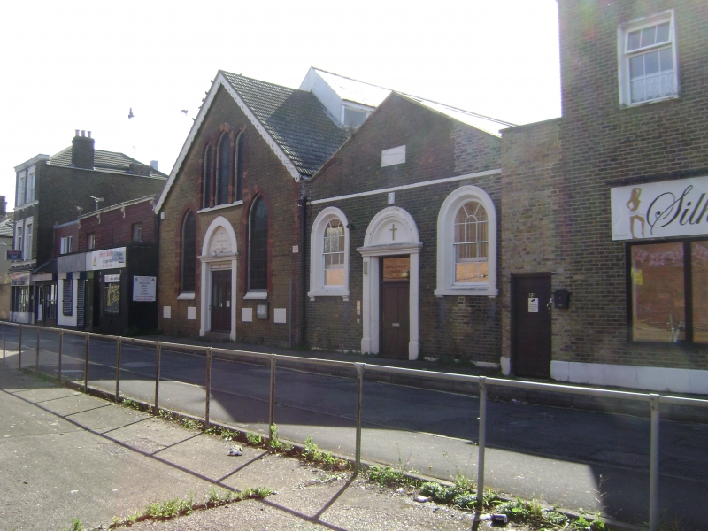
HOPE STREET
1.
5282
(South-East Side)
Mile Town, Sheerness
Bethel Chapel Sunday
School
TQ 9174 NE 8/73
TQ 9274 NW 9/73
II
2.
Bated 1832. 1 storey stock brick. Pediment with stone coping. 2 round-headed
windows with architraves and glazing bars intact. Central round-headed doorcase
with pilasters.
Listing NGR: TQ9199674814
External links are from the relevant listing authority and, where applicable, Wikidata. Wikidata IDs may be related buildings as well as this specific building. If you want to add or update a link, you will need to do so by editing the Wikidata entry.


Other nearby listed buildings
