Approximate Location Map
Large Map »
Latitude: 51.0673 / 51°4'2"N
Longitude: -1.7971 / 1°47'49"W
OS Eastings: 414310
OS Northings: 129788
OS Grid: SU143297
Mapcode National: GBR 51F.2GC
Mapcode Global: FRA 7639.KP2
Plus Code: 9C3W3683+W4
Entry Name: 67 and 69, New Street
Listing Date: 12 October 1972
Grade: II
Source: Historic England
Source ID: 1258399
English Heritage Legacy ID: 444914
ID on this website: 101258399
Location: Salisbury, Wiltshire, SP1
County: Wiltshire
Civil Parish: Salisbury
Built-Up Area: Salisbury
Traditional County: Wiltshire
Lieutenancy Area (Ceremonial County): Wiltshire
Church of England Parish: Salisbury St Thomas and St Edmund
Church of England Diocese: Salisbury
Tagged with: Building
NEW STREET
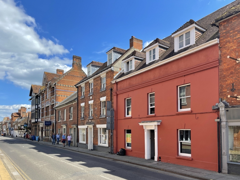
1.
1594 (South Side)
Nos 67 and 69
SU 1429 NW 3/105
II GV
2.
C19 early, 2 storeys, stucco, projecting plinth flat moulded eaves cornice,
parapet and coping probably a slate roof. 3 windows with stucco keystones
first floor. 2 windows and central door ground floor. Glazing bars have been
removed from all windows. 6-Panelled door, plain projecting surround carved
scroll brackets supporting moulded cornice hood.
Nos 21 to 49 (odd), the School of Arts and Crafts, Nos 61, 63 and
Nos 67 to 75 (odd) form a group.
Nos 67 to 75 (odd) also form a group with No 37 High Street.
Listing NGR: SU1431029788
External links are from the relevant listing authority and, where applicable, Wikidata. Wikidata IDs may be related buildings as well as this specific building. If you want to add or update a link, you will need to do so by editing the Wikidata entry.


Other nearby listed buildings
