Approximate Location Map
Large Map »
Latitude: 53.6857 / 53°41'8"N
Longitude: -1.5056 / 1°30'19"W
OS Eastings: 432752
OS Northings: 421136
OS Grid: SE327211
Mapcode National: GBR KTXT.VJ
Mapcode Global: WHC9Z.VM7C
Plus Code: 9C5WMFPV+7Q
Entry Name: Forecourt Walls to Sunny Lawns
Listing Date: 1 February 1979
Grade: II
Source: Historic England
Source ID: 1258495
English Heritage Legacy ID: 445068
ID on this website: 101258495
Location: St Johns, Wakefield, West Yorkshire, WF1
County: Wakefield
Electoral Ward/Division: Wakefield North
Parish: Non Civil Parish
Built-Up Area: Wakefield
Traditional County: Yorkshire
Lieutenancy Area (Ceremonial County): West Yorkshire
Church of England Parish: Wakefield St John the Baptist
Church of England Diocese: Leeds
Tagged with: Wall
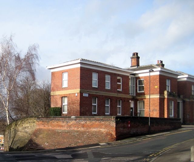
1. SANDY WALK
5115 (formerly Cliff Field
Terrace)
(West Side)
Forecourt Walls to
Sunny Lawns
SE 3221 3/226
II
2.
Mid-late C19. Red brick north wall. Low stone front wall, railings missing.
Pair of stone gate piers at right.
Listing NGR: SE3275221135
External links are from the relevant listing authority and, where applicable, Wikidata. Wikidata IDs may be related buildings as well as this specific building. If you want to add or update a link, you will need to do so by editing the Wikidata entry.


Other nearby listed buildings
