Approximate Location Map
Large Map »
Latitude: 51.3129 / 51°18'46"N
Longitude: 0.1875 / 0°11'14"E
OS Eastings: 552553
OS Northings: 159362
OS Grid: TQ525593
Mapcode National: GBR T3.3Y2
Mapcode Global: VHHPL.68GC
Plus Code: 9F32857P+5X
Entry Name: Gate Piers and Gates to No 23 (The Old Parsonage)
Listing Date: 16 January 1975
Grade: II
Source: Historic England
Source ID: 1259014
English Heritage Legacy ID: 446080
ID on this website: 101259014
OTFORD OTFORD
5280
High Street
(South Side)
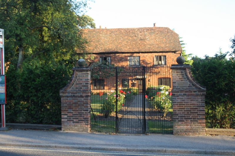
Gate Piers and Gates
to No 23 (The Old Parsonage)
TQ 5259 21/778
II
2.
Modern rusticated square piers, of old bricks, support C18 wrought iron double
gates.
Listing NGR: TQ5255359362
External links are from the relevant listing authority and, where applicable, Wikidata. Wikidata IDs may be related buildings as well as this specific building. If you want to add or update a link, you will need to do so by editing the Wikidata entry.


Other nearby listed buildings
