Latitude: 51.3131 / 51°18'47"N
Longitude: 0.1874 / 0°11'14"E
OS Eastings: 552543
OS Northings: 159379
OS Grid: TQ525593
Mapcode National: GBR T3.3WX
Mapcode Global: VHHPL.68D7
Plus Code: 9F32857P+6W
Entry Name: 48 and 50, High Street
Listing Date: 30 October 1972
Grade: II
Source: Historic England
Source ID: 1273173
English Heritage Legacy ID: 446071
ID on this website: 101273173
Location: Otford, Sevenoaks, Kent, TN14
County: Kent
District: Sevenoaks
Civil Parish: Otford
Built-Up Area: Otford
Traditional County: Kent
Lieutenancy Area (Ceremonial County): Kent
Church of England Parish: Otford St Bartholomew
Church of England Diocese: Rochester
Tagged with: Building
OTFORD OTFORD
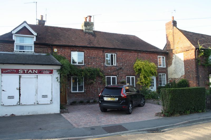
1.
5280
High Street
(North Side)
Nos 48 & 50
TQ 5259 21/765 30.10.72.
II
2.
C18. Each 2 storeys, one window. Tiled roof with moulded eaves cornice. Red
brick with stone plinth. C19 square paned casements, those on ground floor
under segmental brick arches. 4-panel doors.
Listing NGR: TQ5254359379
External links are from the relevant listing authority and, where applicable, Wikidata. Wikidata IDs may be related buildings as well as this specific building. If you want to add or update a link, you will need to do so by editing the Wikidata entry.


Other nearby listed buildings