Approximate Location Map
Large Map »
Latitude: 52.0848 / 52°5'5"N
Longitude: -2.0487 / 2°2'55"W
OS Eastings: 396762
OS Northings: 242936
OS Grid: SO967429
Mapcode National: GBR 2K1.BVQ
Mapcode Global: VHB0R.FVTP
Plus Code: 9C4V3XM2+WG
Entry Name: Barn and Outbuildings Approximately 30 Yards North West of Nash's Farmhouse
Listing Date: 26 March 1986
Grade: II
Source: Historic England
Source ID: 1259156
English Heritage Legacy ID: 446387
ID on this website: 101259156
Location: Little Comberton, Wychavon, Worcestershire, WR10
County: Worcestershire
District: Wychavon
Civil Parish: Little Comberton
Traditional County: Worcestershire
Lieutenancy Area (Ceremonial County): Worcestershire
Church of England Parish: Elmley Castle with Netherton, Bricklehampton, Gt Combrton and Lt Comberton
Church of England Diocese: Worcester
Tagged with: Barn
LITTLE COMBERTON LITTLE COMBERTON
1.
5249
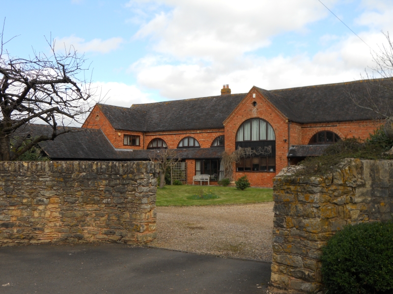
Barn and Outbuildings
approx. 30 yards N.W.
of Nash's Farmhouse
SO 94 SE SP/667
II GV
2.
Barn and outbuildings. Early C19 with later C19 additions. Red brick with tiled roof.
Outbuildings weatherboarded to the front and rubble stone to rear 8 bay barn aligned
east/west. Projecting gabled strey approximately in centre of south and and similar strey
on north side opposite. Brick-dressed full-height arched openings on long sides, blocked
to right of south strey Wide and tall arched entries in all bays to left of south strey
and in all bays on north side blocked with weatherboarding and to south hidden by lean-to
weatherboarded additions. Full-height arch in west end blocked with weatherboarding.
Interior: arches plainly visible between rectangular projecting brick uprights carrying
trusses of queen -post double purlin roof. Single bay to east blocked off and not
accessible at time of inspection (March, 1986). 8-bay outbuildings projecting south from
west end. Included for group virtue.
Listing NGR: SO9676242936
External links are from the relevant listing authority and, where applicable, Wikidata. Wikidata IDs may be related buildings as well as this specific building. If you want to add or update a link, you will need to do so by editing the Wikidata entry.


Other nearby listed buildings
