Approximate Location Map
Large Map »
Latitude: 52.0845 / 52°5'4"N
Longitude: -2.0484 / 2°2'54"W
OS Eastings: 396782
OS Northings: 242903
OS Grid: SO967429
Mapcode National: GBR 2K1.BY0
Mapcode Global: VHB0R.FVZX
Plus Code: 9C4V3XM2+QM
Entry Name: Nash's Farmhouse
Listing Date: 11 February 1965
Grade: II
Source: Historic England
Source ID: 1242788
English Heritage Legacy ID: 443569
ID on this website: 101242788
Location: Little Comberton, Wychavon, Worcestershire, WR10
County: Worcestershire
District: Wychavon
Civil Parish: Little Comberton
Traditional County: Worcestershire
Lieutenancy Area (Ceremonial County): Worcestershire
Church of England Parish: Elmley Castle with Netherton, Bricklehampton, Gt Combrton and Lt Comberton
Church of England Diocese: Worcester
Tagged with: Farmhouse
LITTLE COMBERTON LITTLE COMBERTON
1.
2301
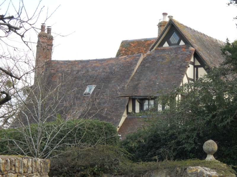
Nash's Farmhouse
SO 94 SE 14/232 11.2.65.
II
2.
C17. Timber frame and plaster. Restored. Tile roof. Stone chimney
with diagonal brick stacks. 2-storeys and attics. Casement windows with
leaded lights.
Listing NGR: SO9678242903
External links are from the relevant listing authority and, where applicable, Wikidata. Wikidata IDs may be related buildings as well as this specific building. If you want to add or update a link, you will need to do so by editing the Wikidata entry.


Other nearby listed buildings
