Latitude: 53.9699 / 53°58'11"N
Longitude: -1.0972 / 1°5'49"W
OS Eastings: 459320
OS Northings: 453025
OS Grid: SE593530
Mapcode National: GBR NQSJ.8N
Mapcode Global: WHFC3.3GTY
Plus Code: 9C5WXW93+X4
Entry Name: Horse Drinking Trough and Canopy
Listing Date: 24 June 1983
Grade: II
Source: Historic England
Source ID: 1259204
English Heritage Legacy ID: 463134
ID on this website: 101259204
Location: York, North Yorkshire, YO30
County: York
Electoral Ward/Division: Clifton
Parish: Non Civil Parish
Built-Up Area: York
Traditional County: Yorkshire
Lieutenancy Area (Ceremonial County): North Yorkshire
Church of England Parish: Clifton St Philip and St James
Church of England Diocese: York
Tagged with: Watering trough Abreuvoir
YORK
SE5953SW CLIFTON GREEN 1112-1/5/214 (East side) 24/06/83 Horse Drinking Trough and canopy
II
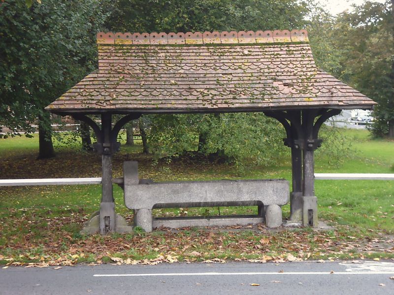
Drinking trough and canopy. Dated 1883. Trough of grey granite. Canopy of oak with tiled roof. Trough of rectangular plan with rounded corners, supported on rectangular blocks of granite and with a shallower trough underneath. Against the north-east side there are 2 granite bollards. The south-east end rises in an ogee shape which formerly carried a spout. Projecting from the outer side is a drinking fountain bowl. Below is the inscribed date '1883'. The canopy roof is half-hipped and has alternate bands of plain and scalloped tiles. The gablets are of oak pierced with trefoils. The roof is supported on 4 posts, with curved braces rising to a rectangular framework of plates supporting struts and rafters. On the 2 long sides cast-iron signs face inwards and are inscribed: 'ANY PERSON INJURING THE TROUGH, COVER, SEAT, OR TREES ON CLIFTON GREEN WILL BE PROSECUTED AS THE LAW DIRECTS'. On the short sides there are plates inscribed:'THE POLICE ARE INSTRUCTED TO APPREHEND ANY ONE PLAYING WITH OR DIRTYING THE WATER'.
Listing NGR: SE5932053025
External links are from the relevant listing authority and, where applicable, Wikidata. Wikidata IDs may be related buildings as well as this specific building. If you want to add or update a link, you will need to do so by editing the Wikidata entry.


Other nearby listed buildings