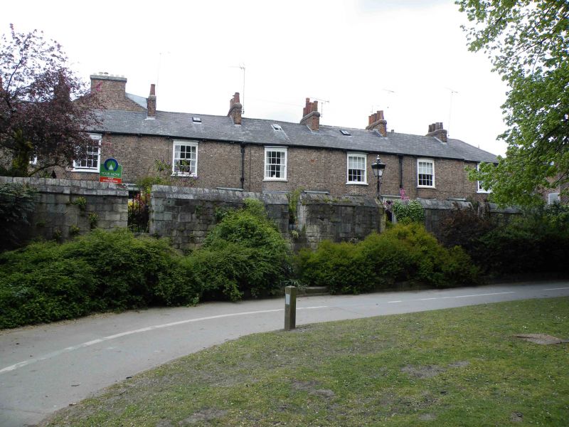
Latitude: 53.9553 / 53°57'19"N
Longitude: -1.081 / 1°4'51"W
OS Eastings: 460403
OS Northings: 451412
OS Grid: SE604514
Mapcode National: GBR NQWP.RW
Mapcode Global: WHFC3.CVH5
Plus Code: 9C5WXW49+4J
Entry Name: City Walls Attached to Tower Place
Listing Date: 24 June 1983
Last Amended: 14 March 1997
Grade: I
Source: Historic England
Source ID: 1259260
English Heritage Legacy ID: 463063
ID on this website: 101259260
Location: Clementhorpe, York, North Yorkshire, YO1
County: York
Electoral Ward/Division: Guildhall
Parish: Non Civil Parish
Built-Up Area: York
Traditional County: Yorkshire
Lieutenancy Area (Ceremonial County): North Yorkshire
Church of England Parish: York All Saints, Pavement
Church of England Diocese: York
Tagged with: City walls
YORK
SE6051SW CITY WALLS 1112-1/21/6 City Wall attached to Tower Place 24/06/83 (Formerly Listed as: TOWER PLACE Wall to south of footpath running from No.9 to Tower Street)
GV I
Defensive wall attached to No.9 Tower Place (qv), extending approximately 60 metres north-east, now forming southern boundary to Tower Place. Probably late C13. Magnesian limestone ashlar. Approximately 2 to 3 metres high with embattled parapet. Cruciform arrow slit towards No.9 (Davy Tower), and head of weathered buttress adjacent to No.2 Tower Place (qv). On inner side of wall a narrow length of original wallwalk survives behind the parapet. Wall ran originally from Davy Tower on the river bank to Castlegate Postern, demolished in 1826. (An Inventory of the Historical Monuments in the City of York: The Defences: HMSO: 1972-: 158).
Listing NGR: SE6040351412
External links are from the relevant listing authority and, where applicable, Wikidata. Wikidata IDs may be related buildings as well as this specific building. If you want to add or update a link, you will need to do so by editing the Wikidata entry.


Other nearby listed buildings