Latitude: 51.0685 / 51°4'6"N
Longitude: -1.792 / 1°47'31"W
OS Eastings: 414668
OS Northings: 129928
OS Grid: SU146299
Mapcode National: GBR 517.XDJ
Mapcode Global: FRA 7649.7PM
Plus Code: 9C3W3695+C5
Entry Name: 34, Milford Street
Listing Date: 12 October 1972
Grade: II
Source: Historic England
Source ID: 1259781
English Heritage Legacy ID: 444117
ID on this website: 101259781
Location: The Friary, Wiltshire, SP1
County: Wiltshire
Civil Parish: Salisbury
Built-Up Area: Salisbury
Traditional County: Wiltshire
Lieutenancy Area (Ceremonial County): Wiltshire
Church of England Parish: Salisbury St Martin
Church of England Diocese: Salisbury
Tagged with: Building
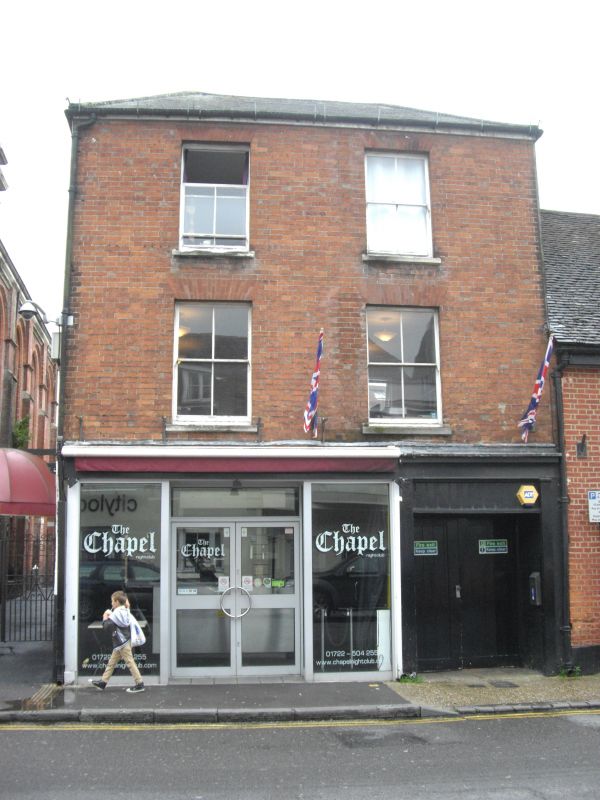
MILFORD STREET 1. 1594 (South Side) No 34 SU 1429 NE 4/524 GV II 2. Mid C19. 3 storeys red brick. Low pitch hipped slate roof. 2 windows to upper floors, recessed sashes, C19 glazing. Ground floor has plain double shop front with flanking strips and double doors to carriageway to right, all under common frieze and plain cornice.
Nos 20 to 36 (even) and Pentecostal Church form a group.
Listing NGR: SU1466829928
External links are from the relevant listing authority and, where applicable, Wikidata. Wikidata IDs may be related buildings as well as this specific building. If you want to add or update a link, you will need to do so by editing the Wikidata entry.


Other nearby listed buildings