Approximate Location Map
Large Map »
Latitude: 51.2814 / 51°16'53"N
Longitude: 1.0748 / 1°4'29"E
OS Eastings: 614532
OS Northings: 158074
OS Grid: TR145580
Mapcode National: GBR TY2.NKN
Mapcode Global: VHLGM.L220
Plus Code: 9F3373JF+HW
Entry Name: 14, Westgate Grove
Listing Date: 7 September 1973
Grade: II
Source: Historic England
Source ID: 1259807
English Heritage Legacy ID: 443886
ID on this website: 101259807
Location: Canterbury, Kent, CT2
County: Kent
District: Canterbury
Electoral Ward/Division: Westgate
Parish: Non Civil Parish
Built-Up Area: Canterbury
Traditional County: Kent
Lieutenancy Area (Ceremonial County): Kent
Tagged with: Building
1.
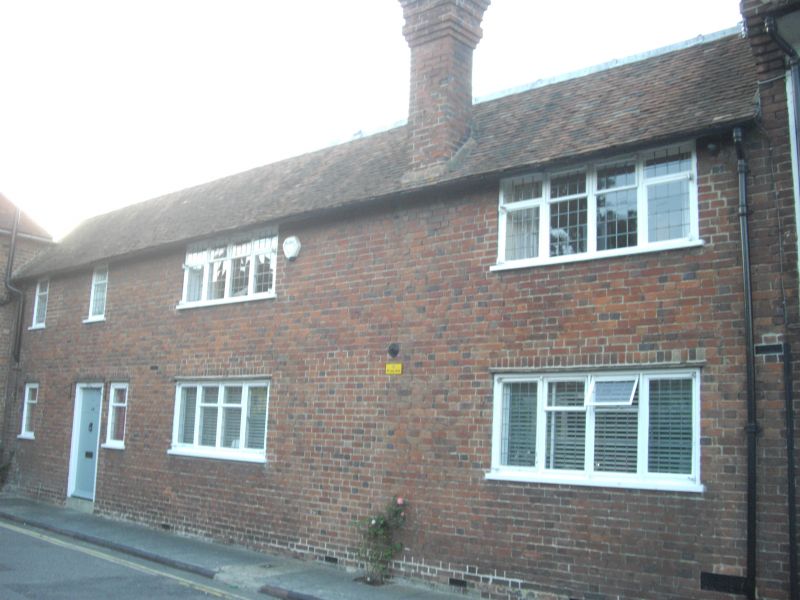
944 WESTGATE GROVE
(North Side)
NO 14
TR 1458 SE 2/341
II GV
2.
Formerly shown as No 2.
C18. A malthouse converted into a dwelling, 2 storeys red brick with tiled
roof. Windows are restored mullioned and transomed casements with leaded
lights. Simple doorcase with 6 Panelled door.
Nos 2 to 14 (even) form a group.
Listing NGR: TR1452658070
External links are from the relevant listing authority and, where applicable, Wikidata. Wikidata IDs may be related buildings as well as this specific building. If you want to add or update a link, you will need to do so by editing the Wikidata entry.


Other nearby listed buildings
