Approximate Location Map
Large Map »
Latitude: 51.2812 / 51°16'52"N
Longitude: 1.075 / 1°4'29"E
OS Eastings: 614542
OS Northings: 158048
OS Grid: TR145580
Mapcode National: GBR TY2.NKQ
Mapcode Global: VHLGM.L246
Plus Code: 9F3373JF+FX
Entry Name: Pier of Bridge in Grounds of Tower House Situated Behind Arch
Listing Date: 7 September 1973
Grade: II
Source: Historic England
Source ID: 1260350
English Heritage Legacy ID: 441020
ID on this website: 101260350
Location: Westgate Gardens, Canterbury, Kent, CT2
County: Kent
District: Canterbury
Electoral Ward/Division: Westgate
Parish: Non Civil Parish
Built-Up Area: Canterbury
Traditional County: Kent
Lieutenancy Area (Ceremonial County): Kent
Tagged with: Bridge
1.
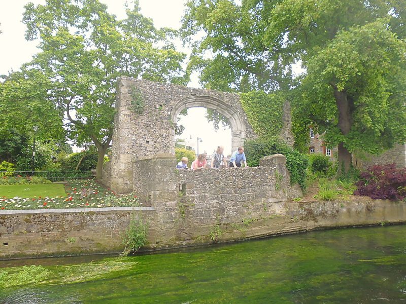
944 ST DUNSTAN'S STREET
Pier of bridge in grounds of
Tower House situated behind arch
TR 1458 SE 2/651
II
2.
Mediaeval of flint with stone quoins.
(See also Westgate Grove. Pier in grounds of No 1).
Listing NGR: TR1454258048
External links are from the relevant listing authority and, where applicable, Wikidata. Wikidata IDs may be related buildings as well as this specific building. If you want to add or update a link, you will need to do so by editing the Wikidata entry.


Other nearby listed buildings
