Latitude: 51.1295 / 51°7'46"N
Longitude: 1.0895 / 1°5'22"E
OS Eastings: 616261
OS Northings: 141233
OS Grid: TR162412
Mapcode National: GBR V01.08B
Mapcode Global: VHLH6.TVTZ
Plus Code: 9F3343HQ+RQ
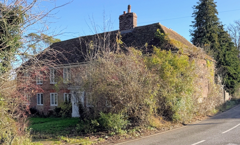
Entry Name: Lindon Hall
Listing Date: 29 December 1966
Last Amended: 17 October 1988
Grade: II*
Source: Historic England
Source ID: 1260204
English Heritage Legacy ID: 441379
ID on this website: 101260204
Location: North Lyminge, Folkestone and Hythe, Kent, CT18
County: Kent
District: Folkestone and Hythe
Civil Parish: Lyminge
Built-Up Area: Lyminge
Traditional County: Kent
Lieutenancy Area (Ceremonial County): Kent
Tagged with: House
TR 14 SE LYMINGE CANTERBURY ROAD (north-east side)
4/141 Lindon Hall (formerly listed as Lyndon Hall) 29.12.66 II*
House. Circa 1668, possibly with earlier core, and with late C18 or early C19 doorcase. Front elevation red and grey brick in Flemish bond. Right return elevation tile-hung on both floors (possibly over brick). Plain tile roof. 2 storeys. Chamfered brick plinth to front elevation, stone plinth to right return. Plan band. Moulded wooden eaves cornice. Hipped roof, right hip returning to rear. Brick ridge stack between second and third windows from right. Regular 8-window front of leaded two-light casements, spaced 4:4 under eaves. Similar ground-floor casements, with pegged mullions and splayed rubbed brick voussoirs. Central panelled door in panelled recess. Unfluted Doric architrave with Ionic-modillioned, corniced hood. Recessed brick or plaster towards front of right gable, dated RF 1668. Short rear return wing to right, with rear gable of red brick in stretcher bond, and roof hipped to rear. Second wing adjoining it, to left of main-range stack, with gable of smaller red and grey bricks in a mixed bond, slightly lower eaves, and hipped plain tile roof. Two further, conjoined, slightly longer rear wings to left, each with lower eaves and ridge, tile-hung gable end and hipped roof. Interior not inspected.
Listing NGR: TR1626141233
External links are from the relevant listing authority and, where applicable, Wikidata. Wikidata IDs may be related buildings as well as this specific building. If you want to add or update a link, you will need to do so by editing the Wikidata entry.


Other nearby listed buildings