Latitude: 51.2835 / 51°17'0"N
Longitude: 1.0715 / 1°4'17"E
OS Eastings: 614291
OS Northings: 158295
OS Grid: TR142582
Mapcode National: GBR TY2.FQD
Mapcode Global: VHLGF.JZBZ
Plus Code: 9F3373MC+9J
Entry Name: 39-42, St Dunstan's Street
Listing Date: 7 September 1973
Grade: II
Source: Historic England
Source ID: 1260310
English Heritage Legacy ID: 441108
ID on this website: 101260310
Location: St Dunstan's, Canterbury, Kent, CT2
County: Kent
District: Canterbury
Electoral Ward/Division: Westgate
Parish: Non Civil Parish
Built-Up Area: Canterbury
Traditional County: Kent
Lieutenancy Area (Ceremonial County): Kent
Tagged with: Building
This list entry was subject to a Minor Amendment on 15 August 2025 to reformat the text to current standards
TR 1458 SW
1/320
ST DUNSTAN'S STREET (south west side)
Nos 39 to 42 (consec)
GV
II
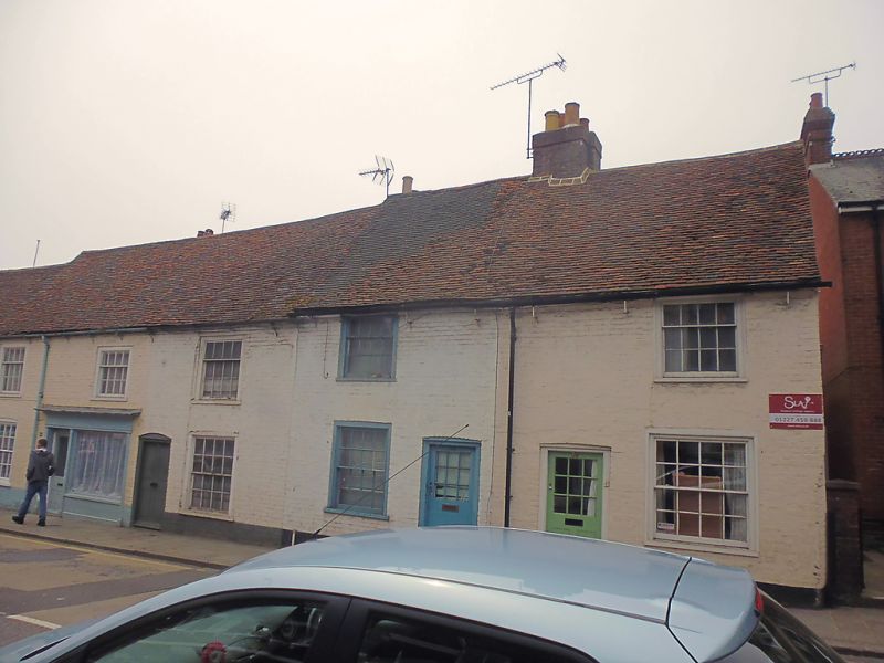
C18 exteriors to possible medieval buildings. Two storeys painted brick. Old tiled roof. Five sashes in all with glazing bars intact. Guttering supported by simple wrought iron brackets. Simple cambered doorcases and shopfront with panelled riser to No 42.
Nos 39 to 45 (consec) form a group.
Listing NGR: TR1429158293
External links are from the relevant listing authority and, where applicable, Wikidata. Wikidata IDs may be related buildings as well as this specific building. If you want to add or update a link, you will need to do so by editing the Wikidata entry.


Other nearby listed buildings